SPITI VALLEY, HIMACHAL PRADESH | WINDOWS TO VERNACULAR
Domestic Vernacular of cold desert
2025
CLIMATE
ARID COLD DESERT
ALTITUDE
AVG. 3500 MTR
PRIMARY MATERIAL
ADOBE, POPLAR, WILLOW, STONE
The "middle land"- enclosed on all sides
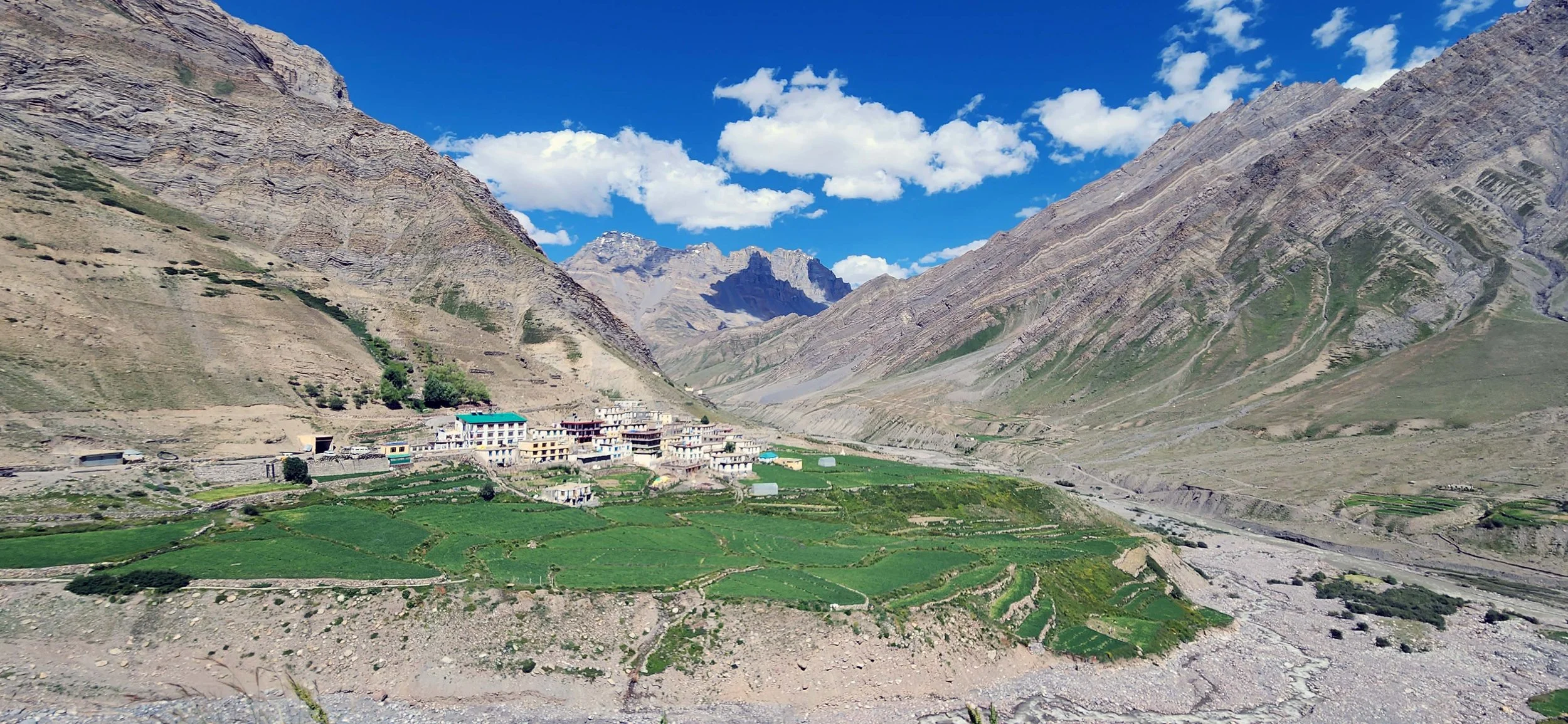
Located on the southwestern edge of the Tibetan Plateau, the Spiti Valley is a high-altitude, cold desert characterised by extreme terrain, harsh climate, and prolonged isolation. Often referred to as the "middle land," Spiti is enclosed by mountain ranges on all sides and historically lay between the former Himalayan empires of Bushahr, Kullu, Ladakh, and Tibet.
This enclosed setting, together with high elevation and severe environmental conditions, has significantly shaped the region's landscape, ecology, and patterns of human habitation. The valley system is defined primarily by the Spiti River and its major tributary, the Pin River, which originates in the Western Himalayas at approximately 4,900 metres and flows southeast before joining the Sutlej River.
In this context, vernacular architecture constitutes a body of knowledge shaped by climate, material availability, culture, and lived experience, rather than by formal design authorship. Rammed-earth walls reduce indoor temperatures by approximately 10°C in summer and retain warmth during winter. This construction knowledge is transmitted orally across generations.
01 THE VALLEY
Where geography authors architecture
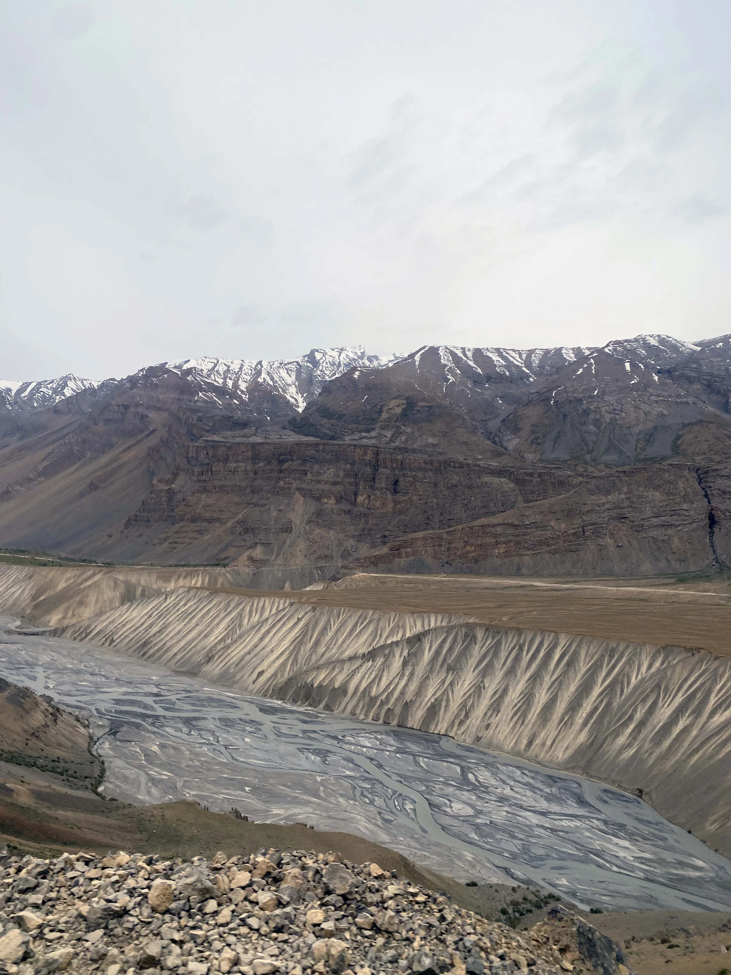
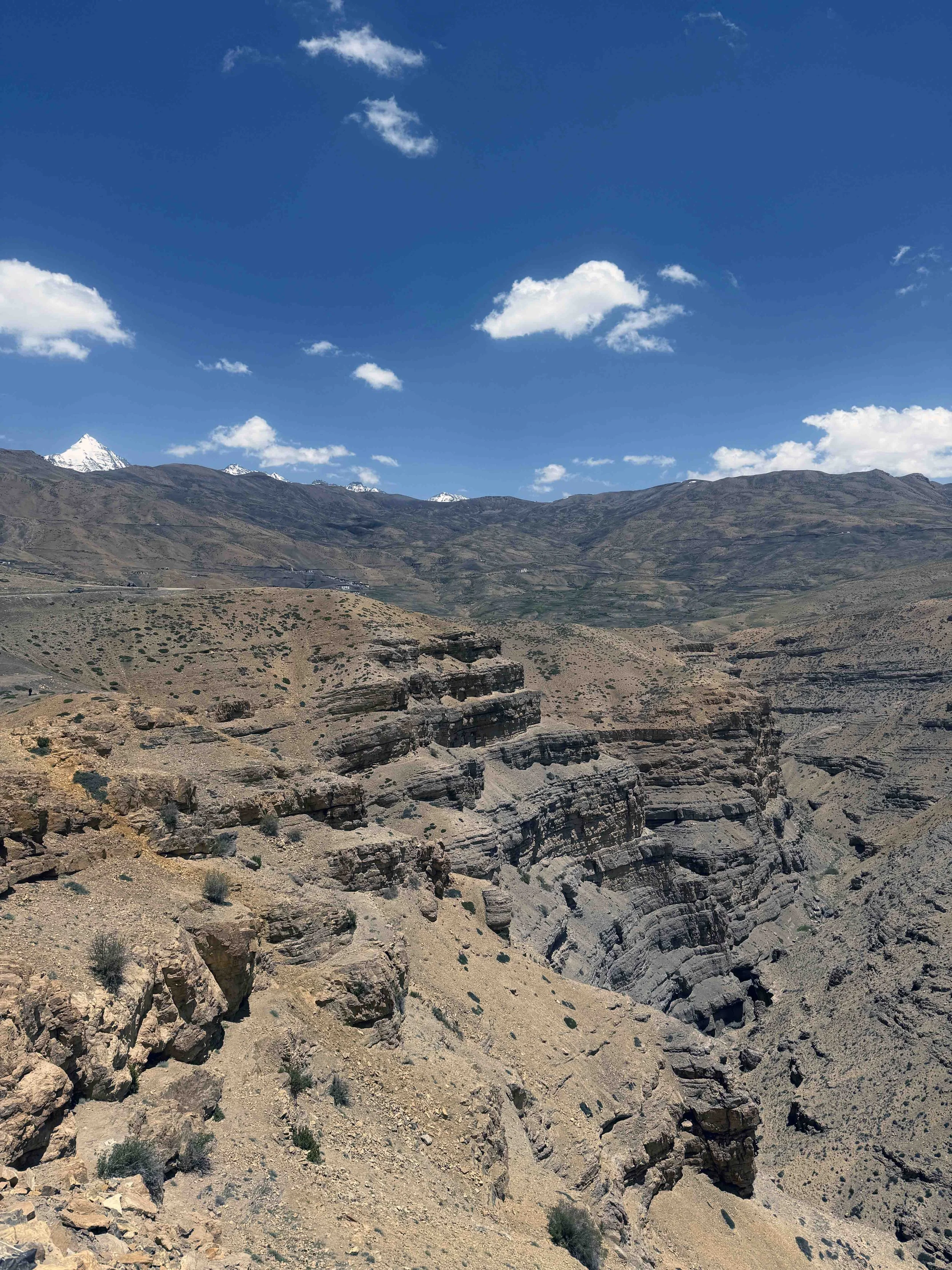
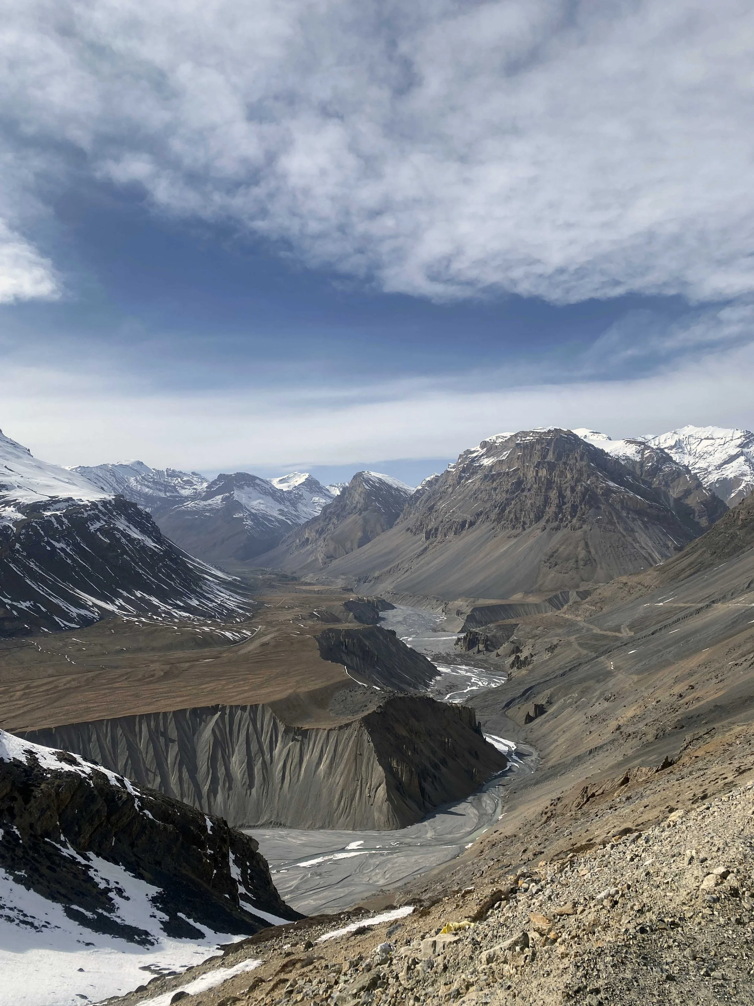
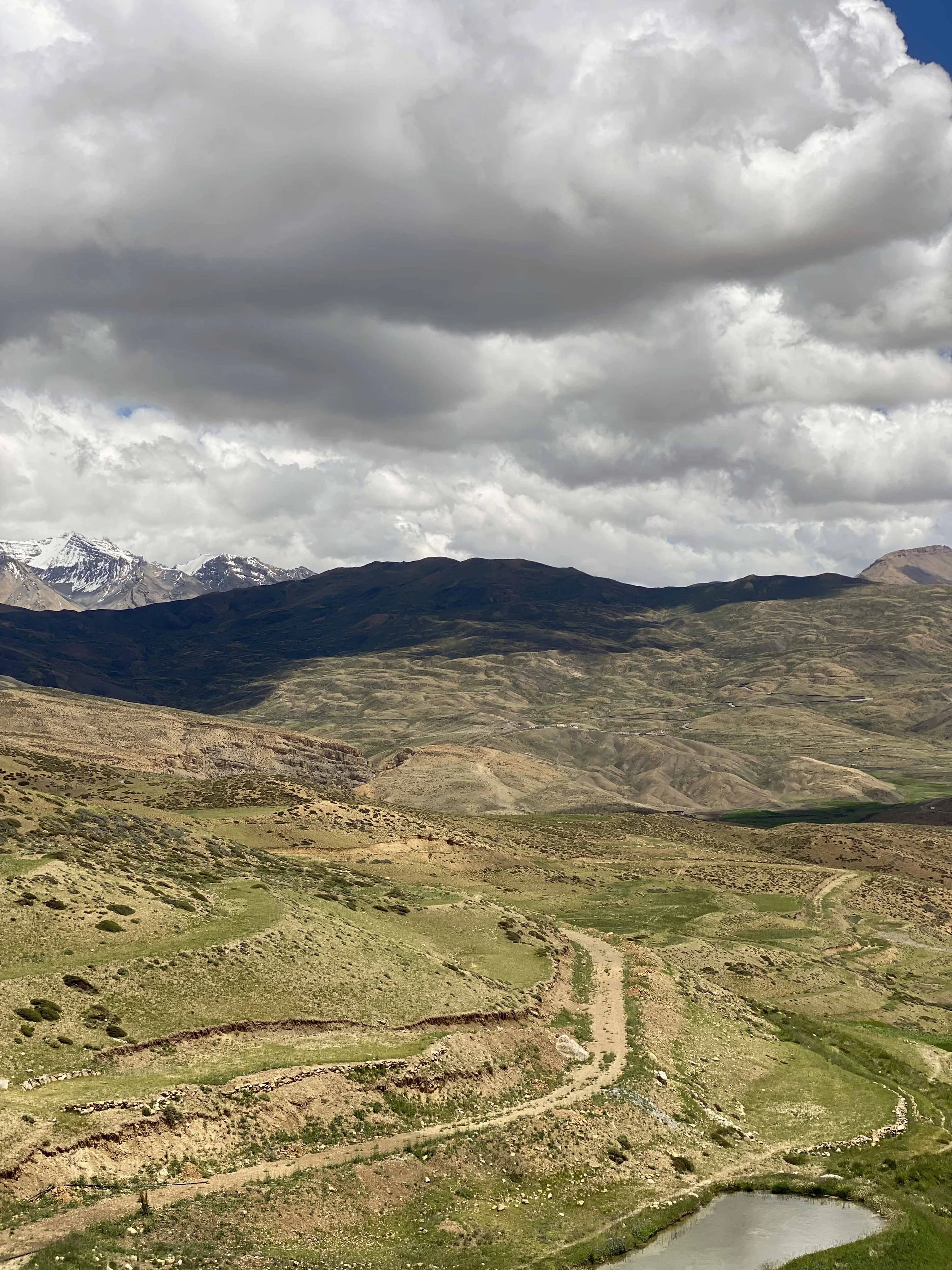
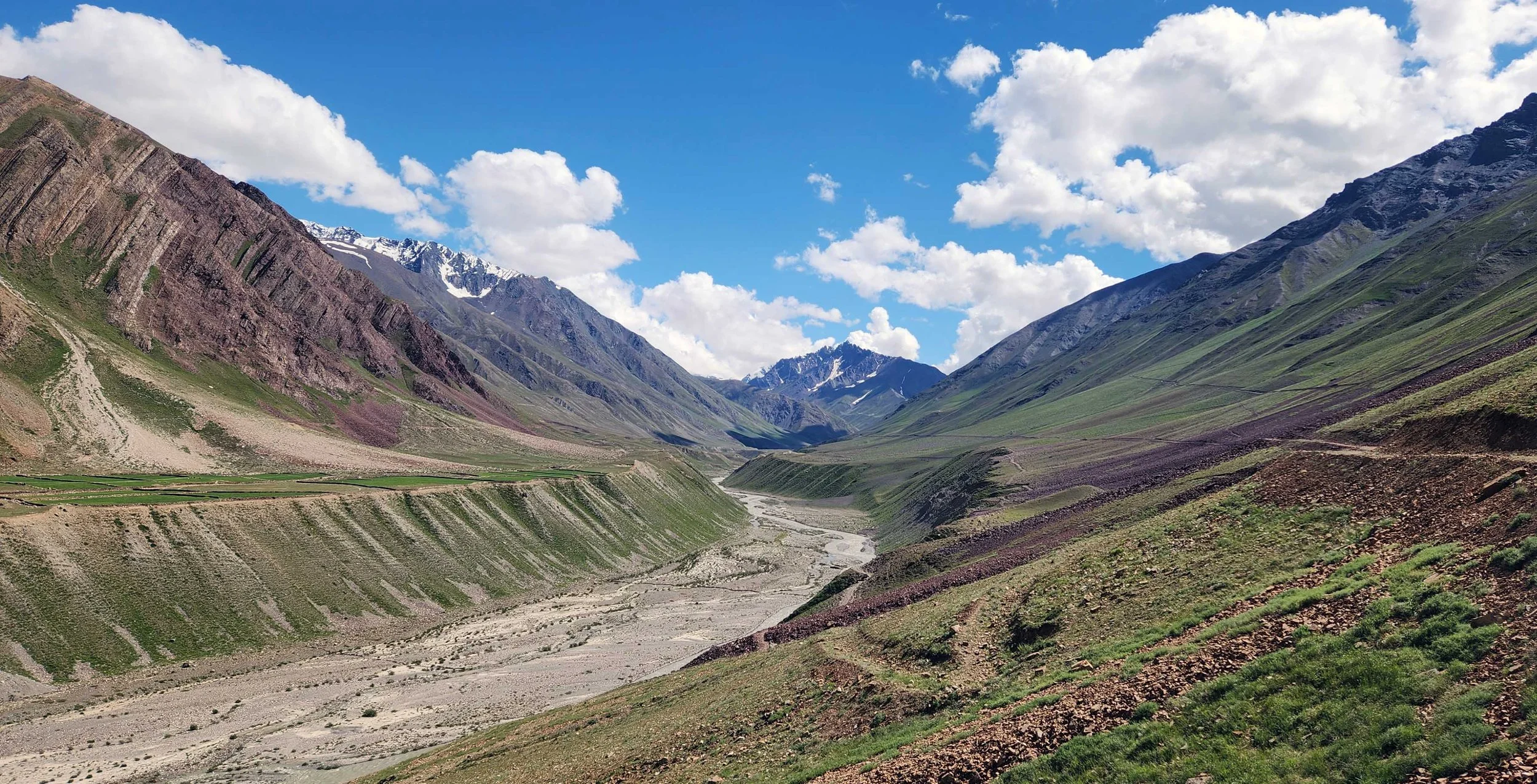
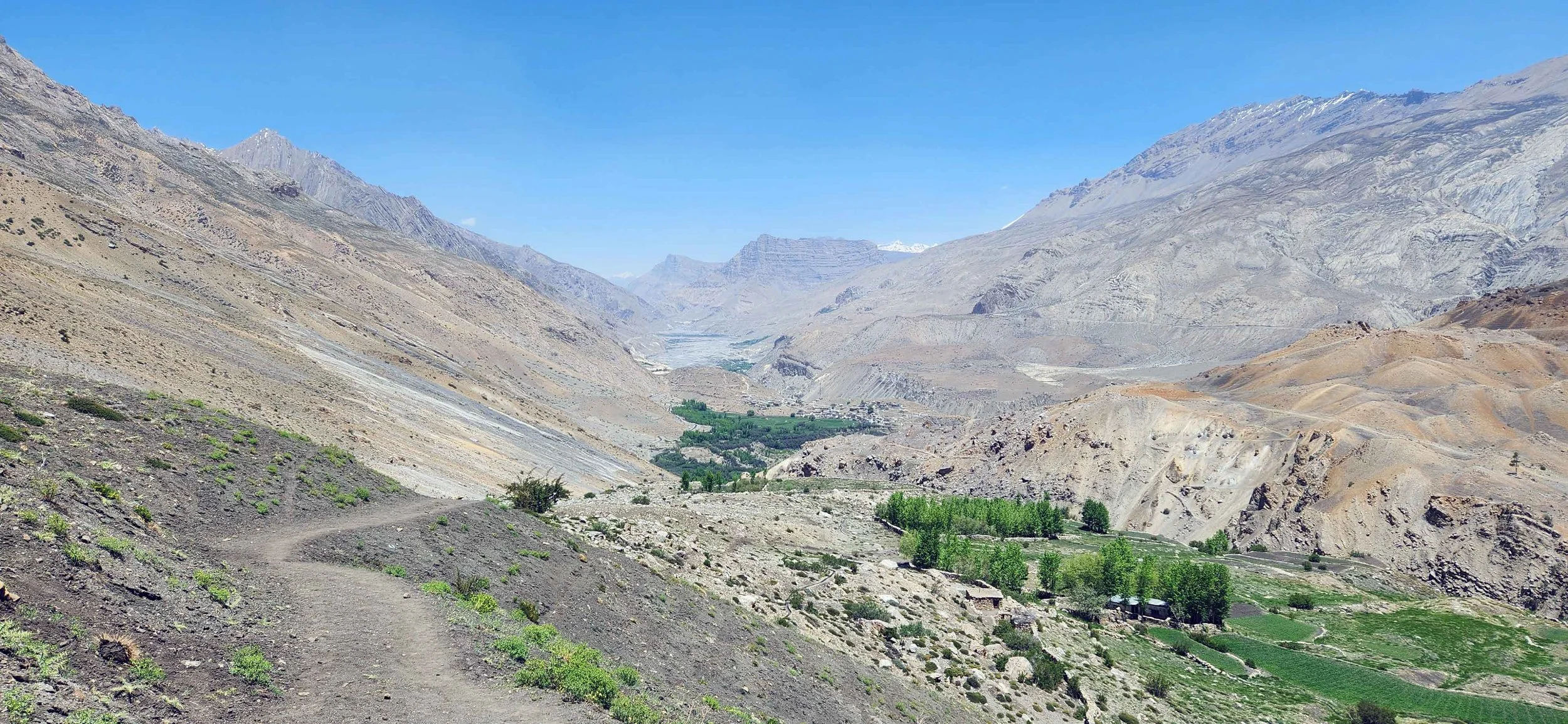
Geomorphologically, the valley is characterised by intense erosion, with friable lime and sandstone soils that form deep gorges, steep riverbanks, and elevated terraces where most settlements are situated. Vegetation is sparse, consisting primarily of dry alpine steppe, and agriculture depends almost entirely on irrigation from glacial meltwater.
Spiti lies in the north-eastern part of the Lahaul and Spiti district of Himachal Pradesh within the Trans-Himalayan region at the western margin of the Tibetan Plateau. It is bounded by the Tibetan Autonomous Region of China to the east, Lahaul to the west, Kullu and Kinnaur to the south, and Ladakh to the northwest. The region covers approximately 4,865 square kilometres. Despite its large geographical extent, Spiti supports a sparse population due to limited agricultural potential and extreme climatic conditions.
The recorded history of Spiti dates back to the 10th century, though its earlier political affiliations can be traced through broader territorial histories. Prior to the 7th century, Spiti, along with Lahaul, formed part of the ancient kingdom of Zhang Zhung. Between the 7th and 9th centuries, the region was incorporated into the expanding Tibetan Empire, followed by its inclusion within the Guge Kingdom — a major centre of political and religious influence in western Tibet.
"Vernacular architecture represents a body of knowledge defined by climate, material availability, culture, and lived experience rather than formal design authorship."
Spiti's location along the Indo-Tibetan frontier historically established it as a significant corridor within trans-Himalayan trade networks. The annual La Darcha festival, held near Kibber and Chicham in July, served as a venue for traders from Ladakh, Rampur Bushahr, Spiti, and Tibet to exchange goods such as livestock, yaks, purebred horses, salt, wool, dried fruits, and metalwork. Ladakh, Zanskar, and Kinnaur maintained cultural relations, seasonal migration, and economic interdependence, although each region was shaped by distinct geographic conditions.
02 THREE SETTLEMENT TYPOLOGIES
Relationship to topography & river
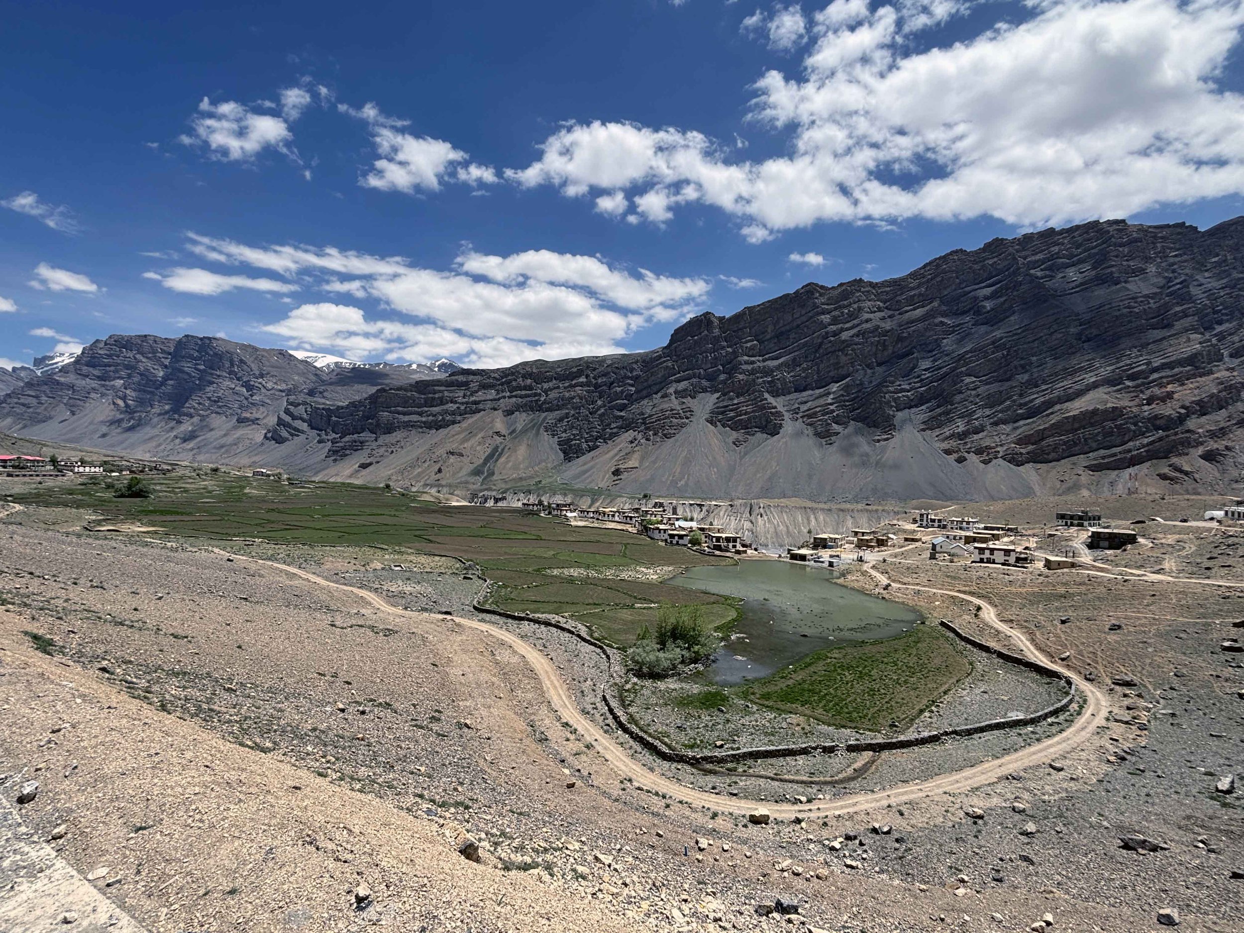
The extreme geography and climate of Spiti play a critical role in determining the emergence and distribution of settlements. Of the 113 recorded settlements, 32 are currently uninhabited, while the remaining are distributed across 81 villages. This uneven distribution underscores the selective nature of habitation in the valley. Settlements can be classified into three types based on their relationship to topography and the river system.
TYPE 01 - BASIN
Basin Settlements
20-50m above riverbed - Easiest water access
These settlements are situated 20-50 metres above the riverbed, typically on relatively flat land or gently sloping terraces, which allows irrigation water to be diverted directly from the river. This location provides easier access to water resources, supporting denser habitation and agricultural activities. The proximity to the river enables gravity-fed khul irrigation without the need for elaborate channels.
Tabo - 10,760 ft
Kaza - 11,980 ft
Losar - 13,240 ft
Hull - 12,640 ft
Pangmo - 12,700 ft
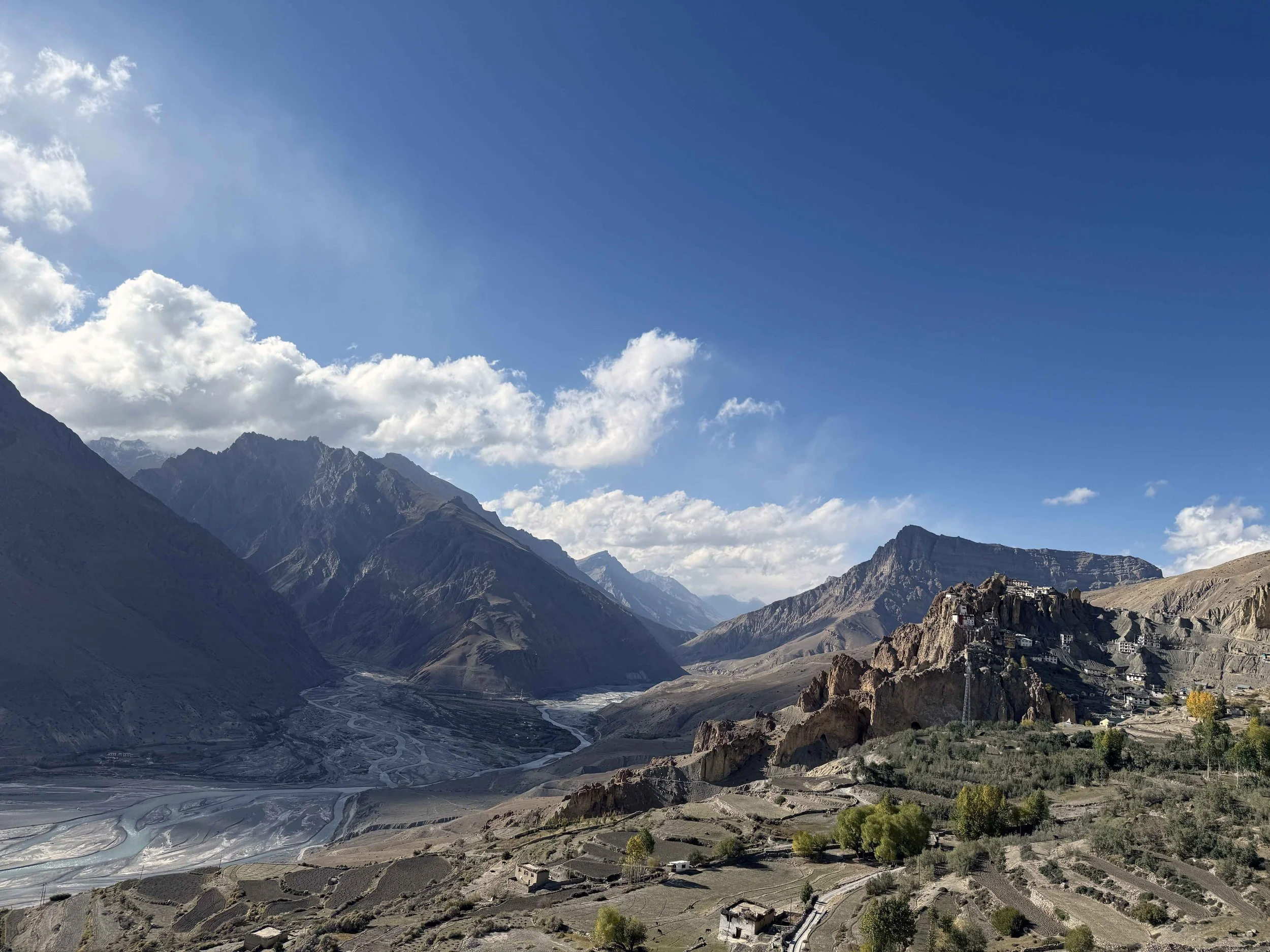
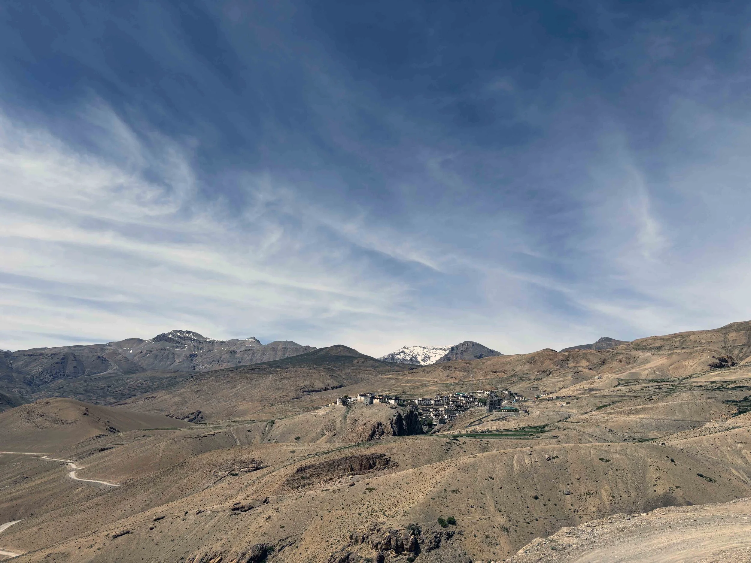
TYPE 02 - CONTOURED
Contoured Settlements
50-100m above river level - Spring & glacial water
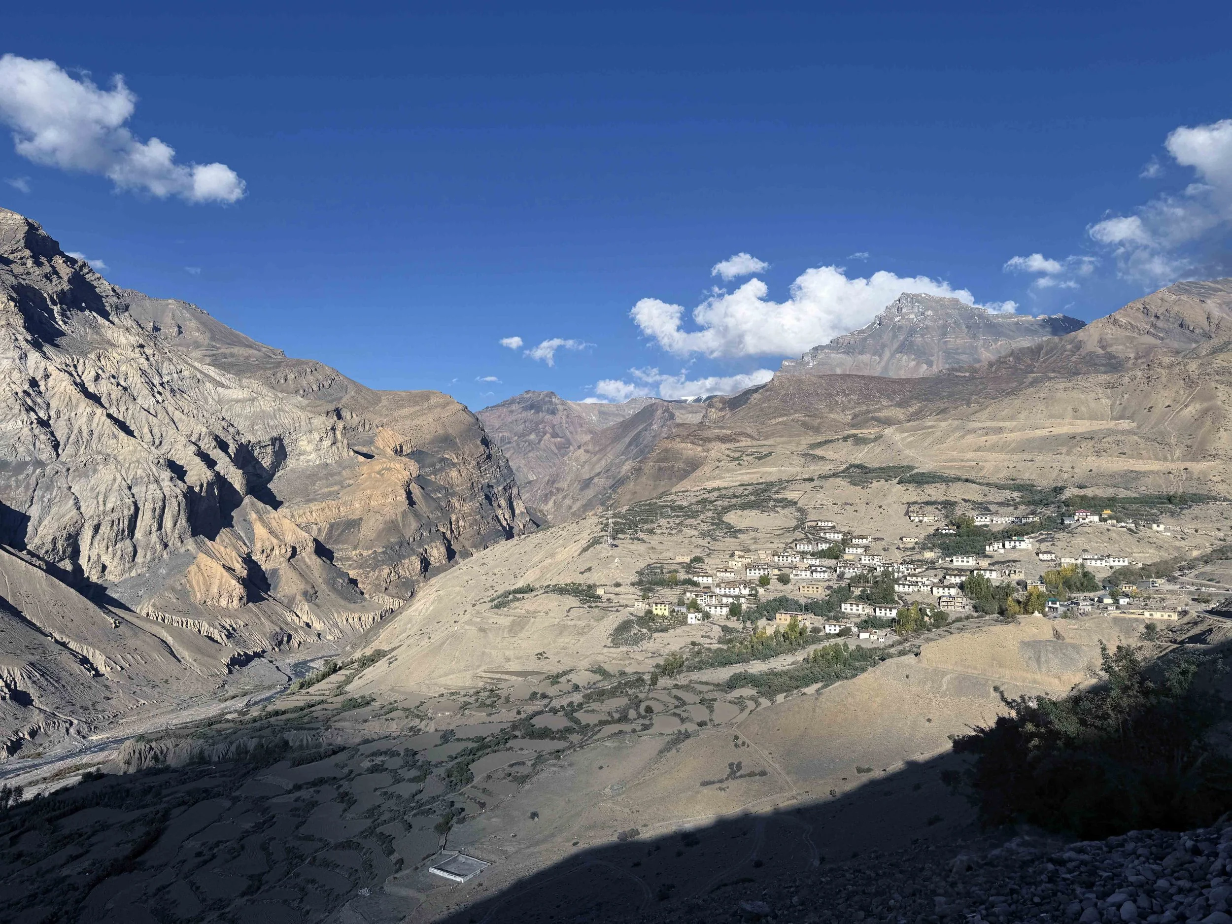
These settlements are located 50-100 metres above the river level and are separated from the river by sharply cut banks. Villages of this type rely primarily on springs and glacial melt for water. The reduced risk of flooding helps protect the structural integrity of village buildings and supports a more sustainable water supply through alternative sources. Houses are clustered to mitigate strong winds and minimise heat loss.
Kibber - 14,010 ft
Dhankar - 12,774 ft
Maney - 11,980 ft
Key - 13,668 ft
Chicham - 13,596 ft
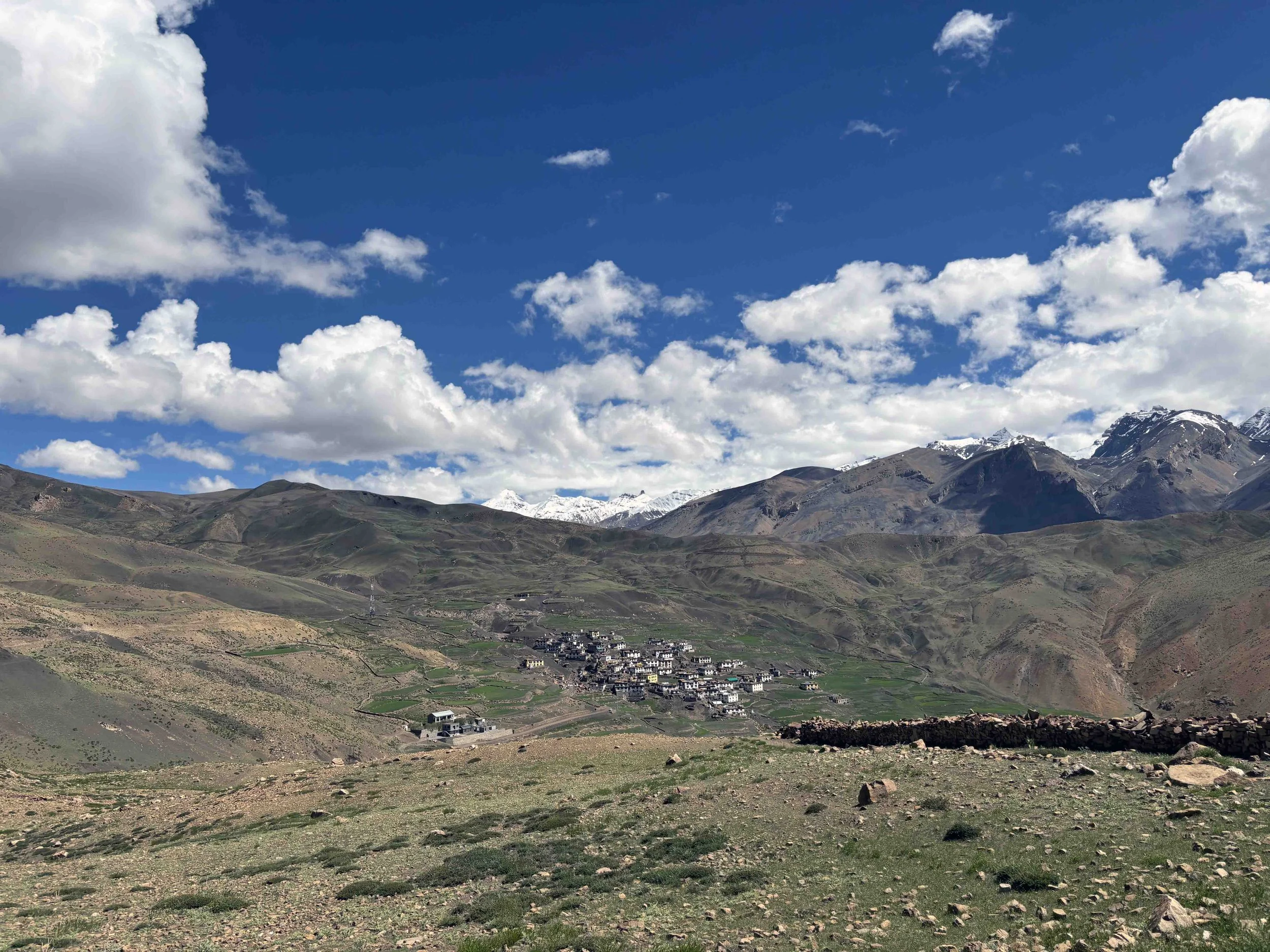
TYPE 03 - HIGHLAND
Highland Settlements
500 m + above riverbed - Snowmelt dependent
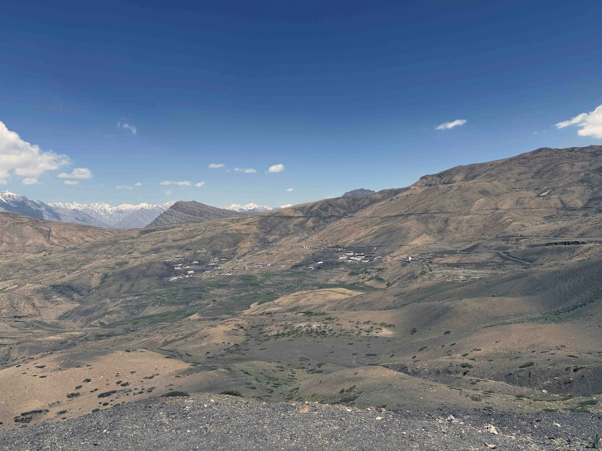
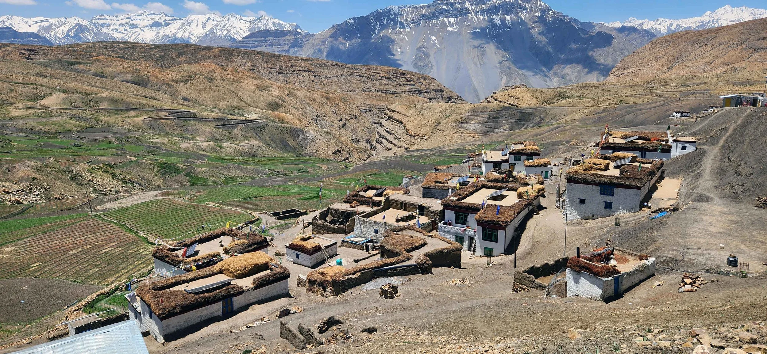
These are the most elevated settlements, situated on high plateaus or terraced slopes, completely disconnected from river access. Such settlements depend entirely on snowmelt for water. The primary advantage is strategic protection against environmental threats such as erosion and external incursions, although this protection requires innovative solutions to maintain water and food supplies. Courtyards in these settlements serve as communal spaces during winter.
Tashigang - 15,256 ft
Langza - 14,500 ft
Komic - 15,027 ft
Hikkim - 14,400 ft
Demul - 14,170 ft
03 DOCUMENTED HOUSES
Three villages, one spatial logic
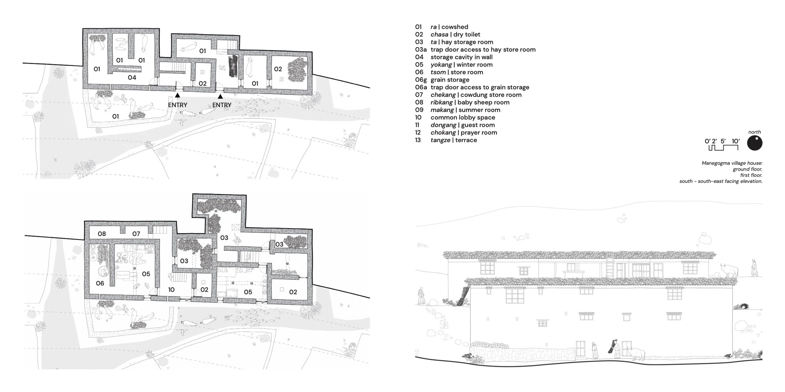
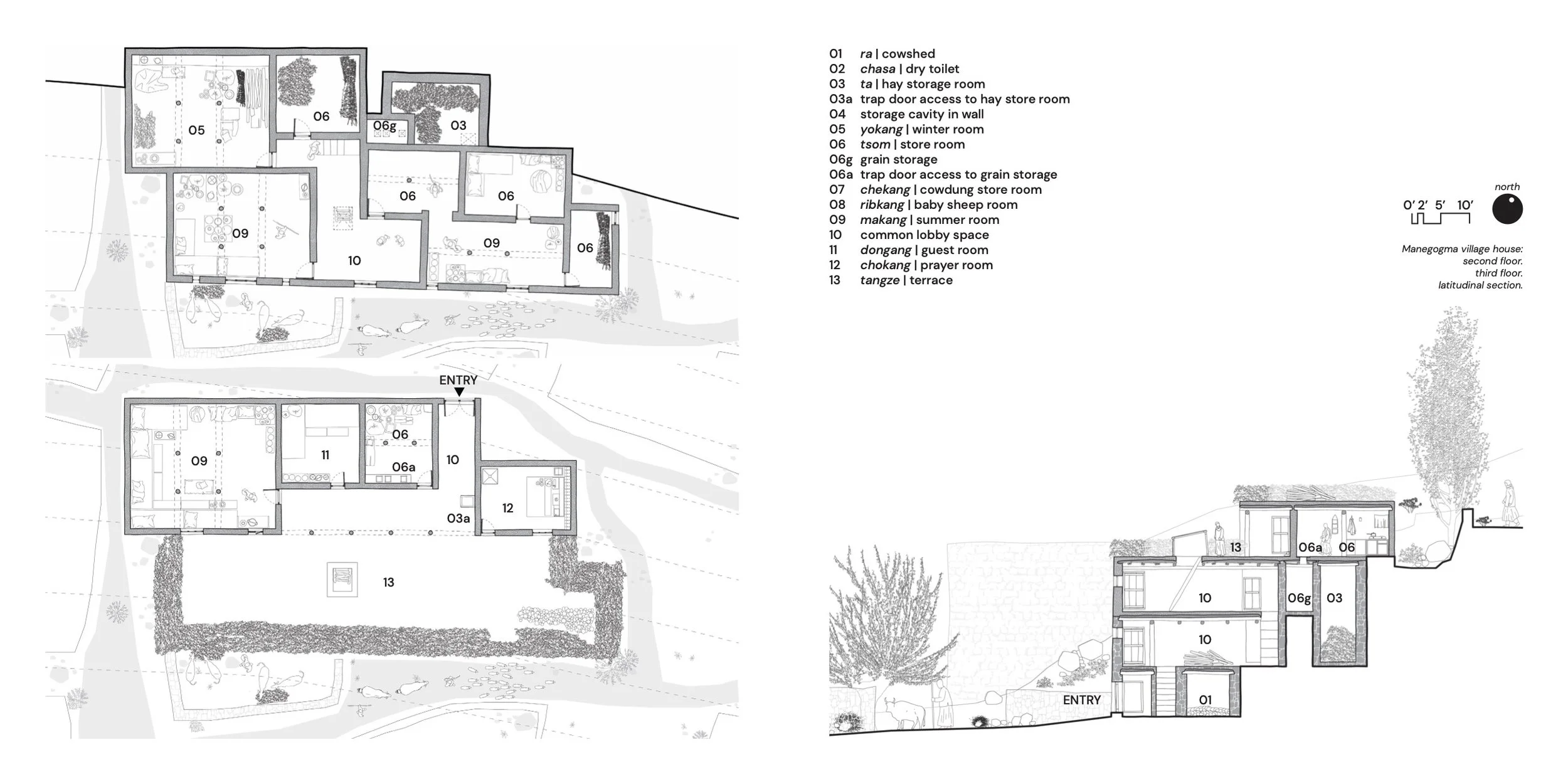
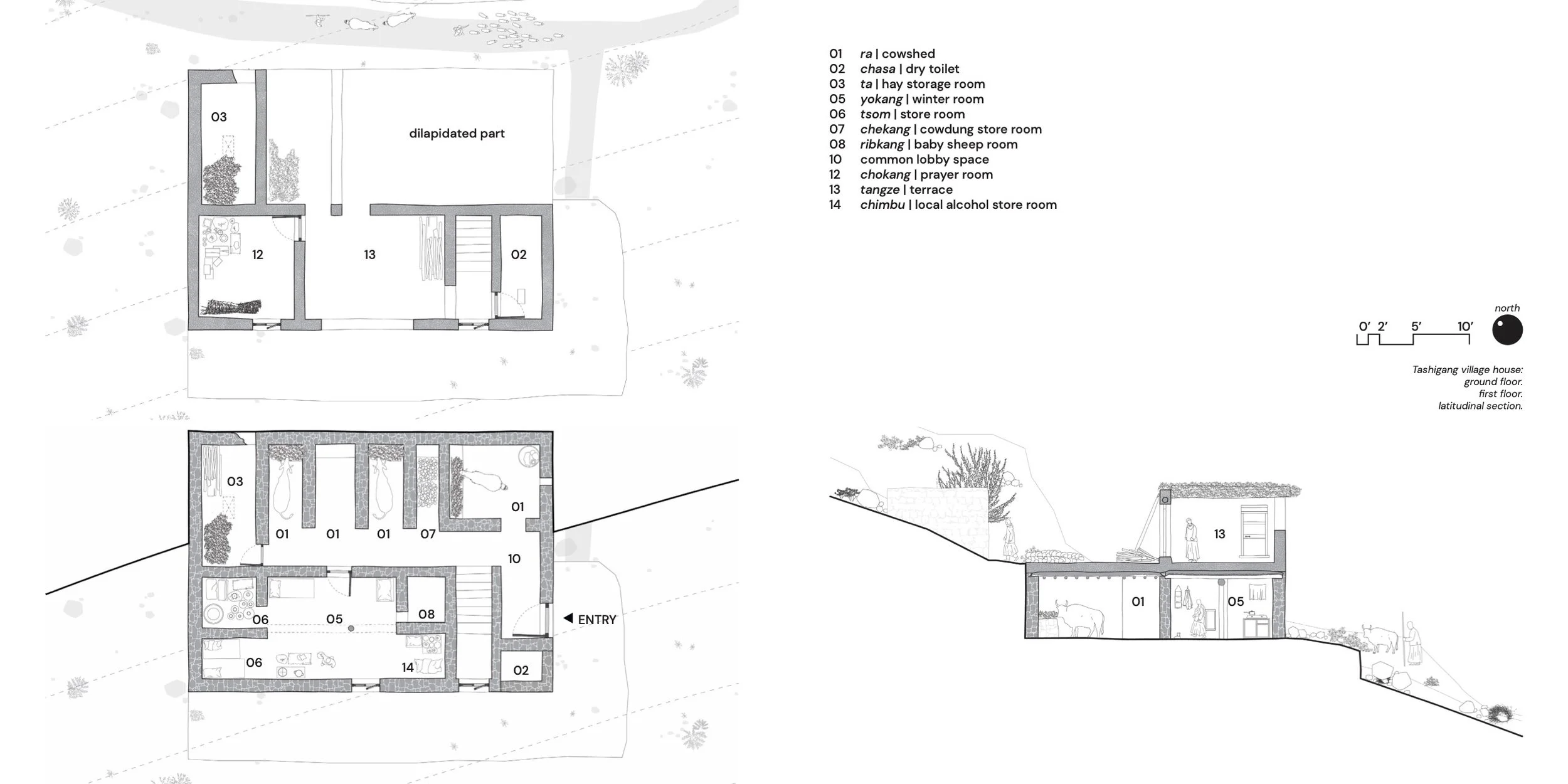
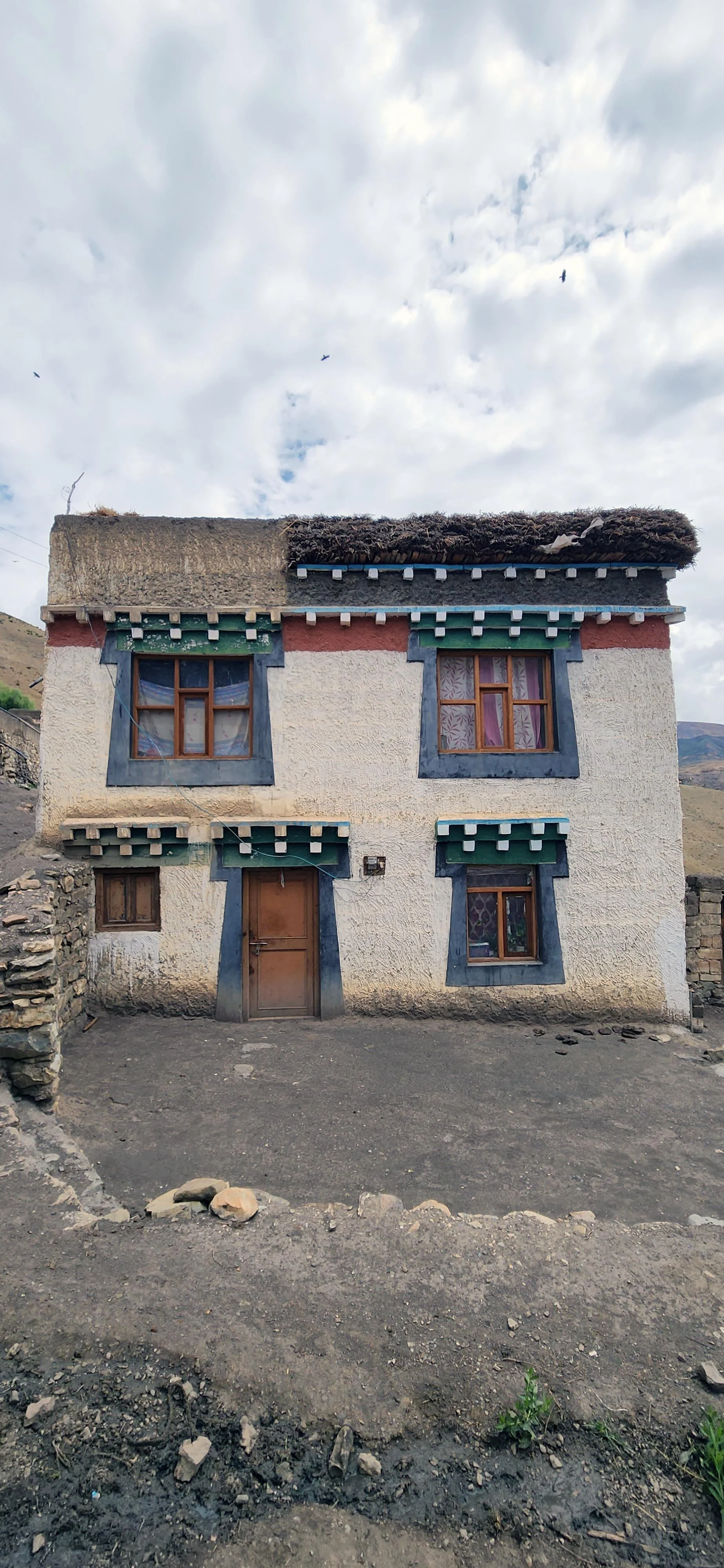
Despite topographical variation, all houses share common planning features: dedicated spaces for animals, food reserves for winter, a toilet, storage, a prayer room, and a kitchen. Floor heights typically range from 8 feet (2.4 m) to 9 feet (2.7 m), maintaining a low volume to minimise thermal losses. The houses are generally rectangular in plan, with a central corridor connecting the rooms. Three houses documented in Manegogma, Kibber, and Chicham, represent the three settlement typologies.
BASIN SETTLEMENT
Manegogma Village House
3,650m / 11,980 ft - south-south-east elevation
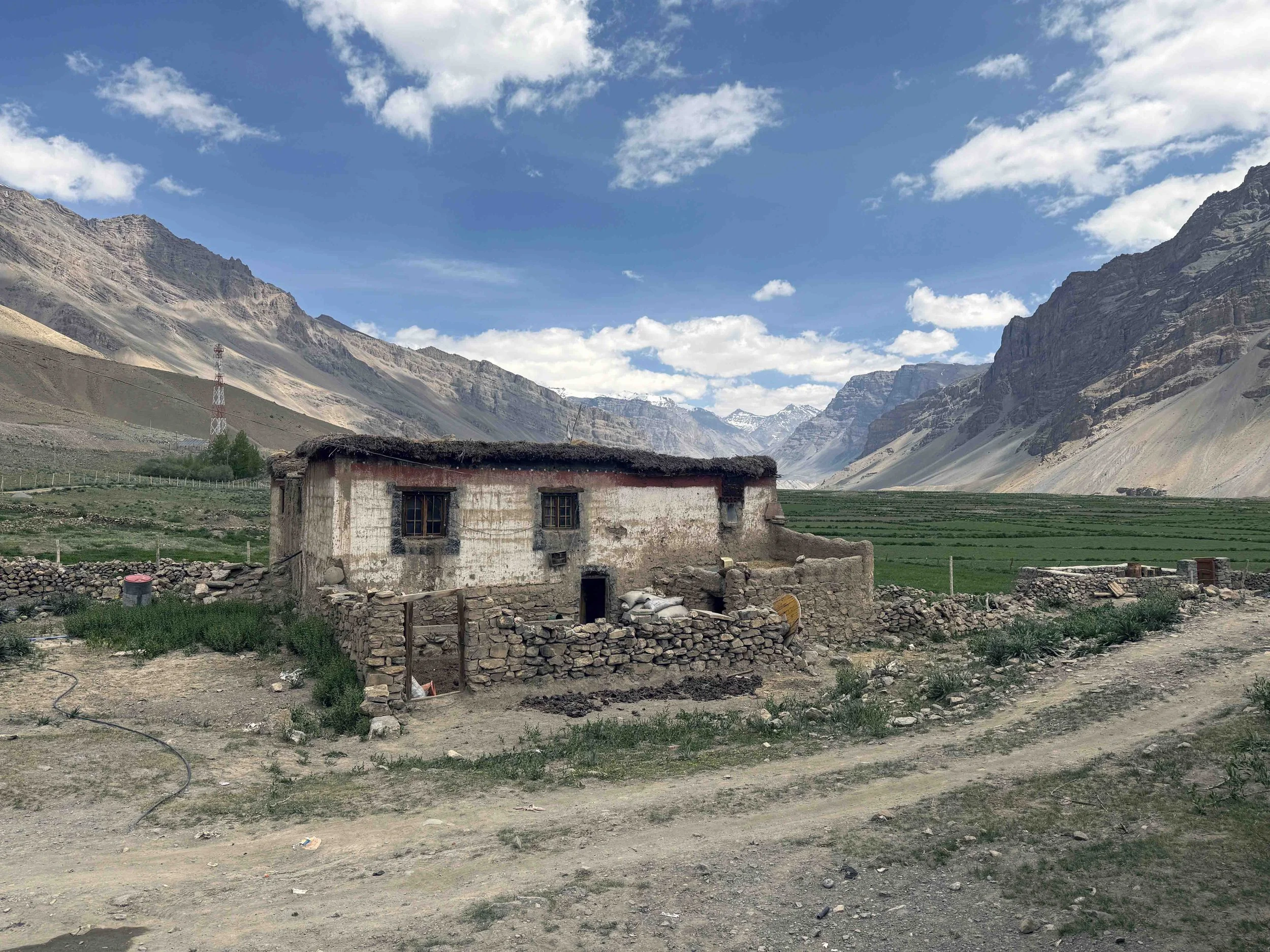
This four-storey house in the valley basin demonstrates the full vertical program, from the cowshed at the ground level to the terrace at the top. It provides the most comprehensive documentation of the Spiti house type, illustrating all spaces across the ground, first, second, and third floors. The south-south-east facing elevation maximises winter solar gain. The ground floor is constructed of stone masonry, while the upper floors are built with rammed earth or adobe. An internal staircase connects all levels.
Ra Cowshed
Chasa Dry toilet (composting)
Ta Hay storage room
Yokang Winter room
Tsom Store room
Chekang Cowdung store room
Ribkang Baby sheep room
Makang Summer room
Dongang Guest room
Chokang Prayer room
Tangze Terrace / flat roof
CONTOURED SETTLEMENT
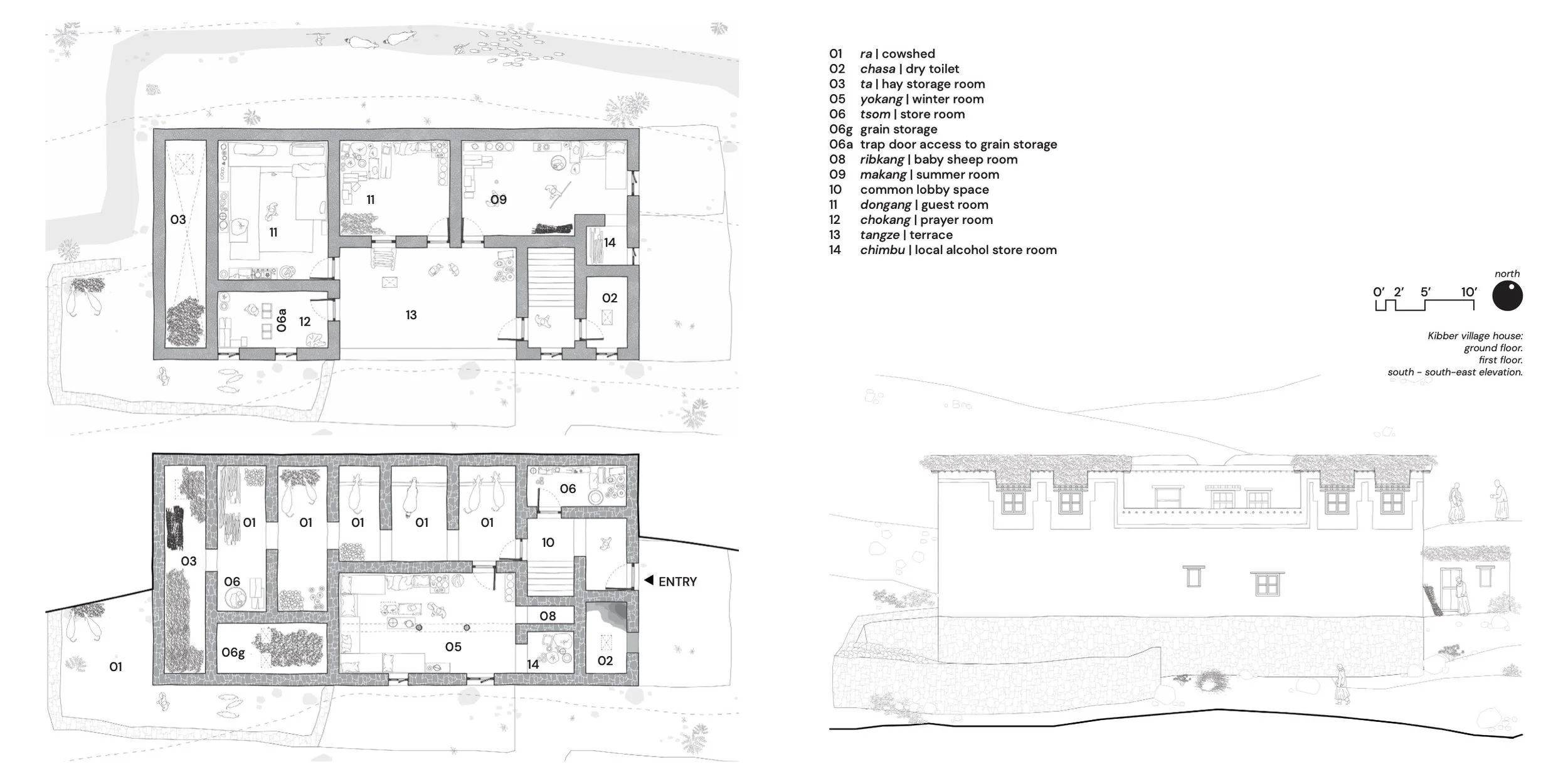
Kibber Village House
4,270m / 14,010 ft · south-south-east elevation
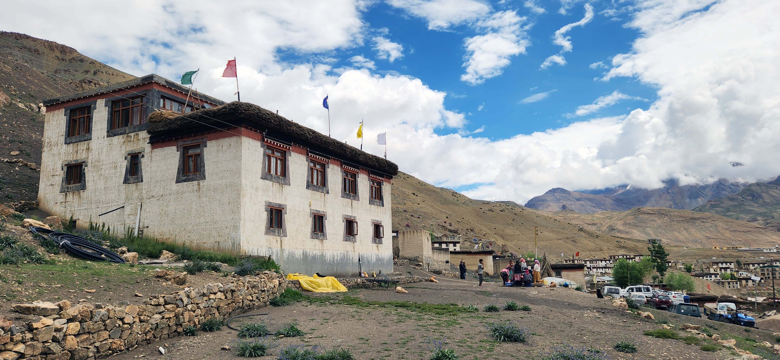
This three-storey house represents the contoured settlement typology. At this altitude, the winter room (yokang) is essential and is designed with minimal openings, relying on heat from livestock below and the clay hearth for warmth. The ground floor is constructed of stone masonry and is earth-bermed along the north face to regulate thermal insulation. The chimbu (local alcohol store room) is a distinctive addition that reflects local food culture. Access is determined by orientation to the south-east sun axis.
Ra Multiple cowsheds
Chasa Dry toilet
Ta Hay storage
Yokang Winter room
Tsom Store room
Makang Summer room
Dongang Guest room
Chokang Prayer room
Tangze Terrace
Chimbu Local alcohol store room
HIGHLAND
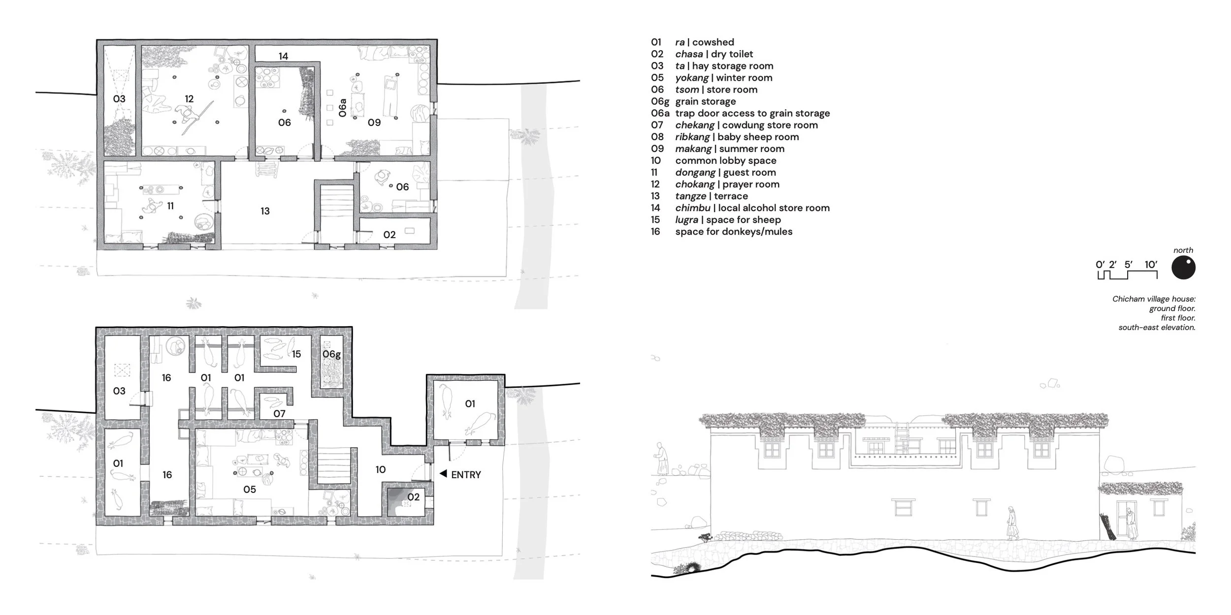
Chicham Village House
4,150m / 13,596 ft · south-east elevation
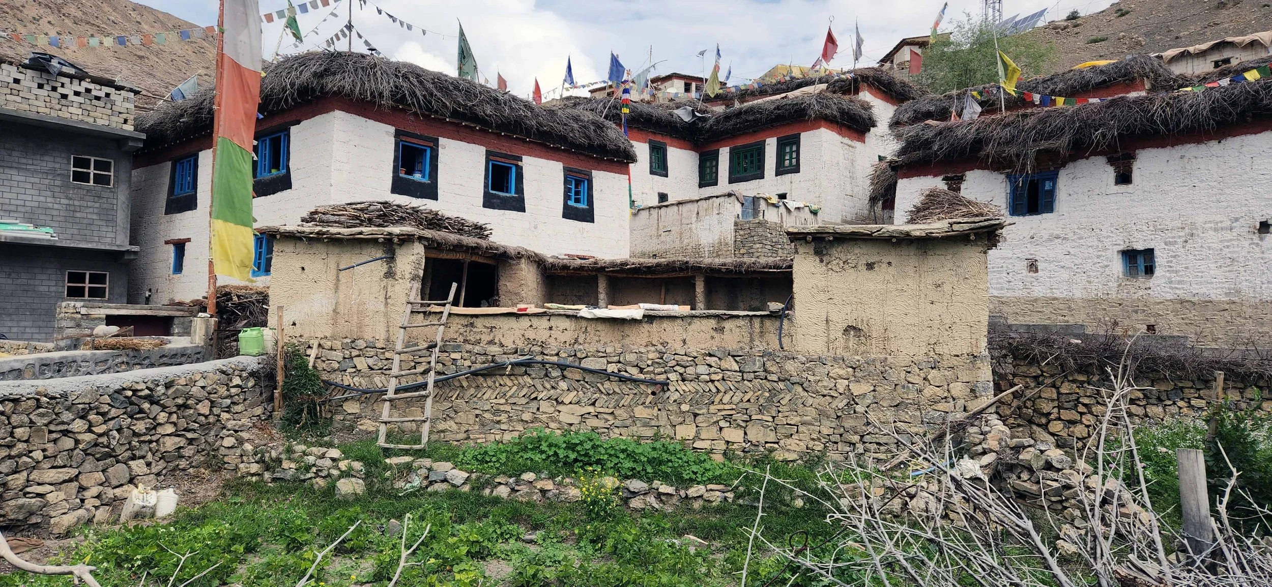
This three-storey house at a high elevation features a distinctive upper-level courtyard, a characteristic found only in the highest-altitude villages such as Chicham, Hikkim, and Langza. The upper-level courtyard serves as a communal family space during the harsh winter months when snow accumulation renders the ground level inaccessible. Road access is via the north axis, with the main entrance to the house on the upper level, adjacent to the road. The house includes spaces for sheep (lugra) and donkeys or mules in addition to the standard cowshed.
Ra Cowshed
Lugra Space for sheep
Chekang Cowdung store
Yokang Winter room
Makang Summer room
Dongang Guest room
Chokang Prayer room
Chasa Dry toilet
Tangze Terrace + courtyard (upper)
04 CONSTRUCTION SYSTEMS
Mud and stone, timber as exception
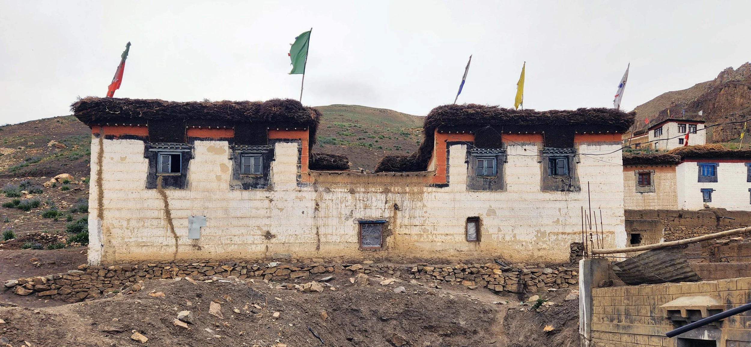
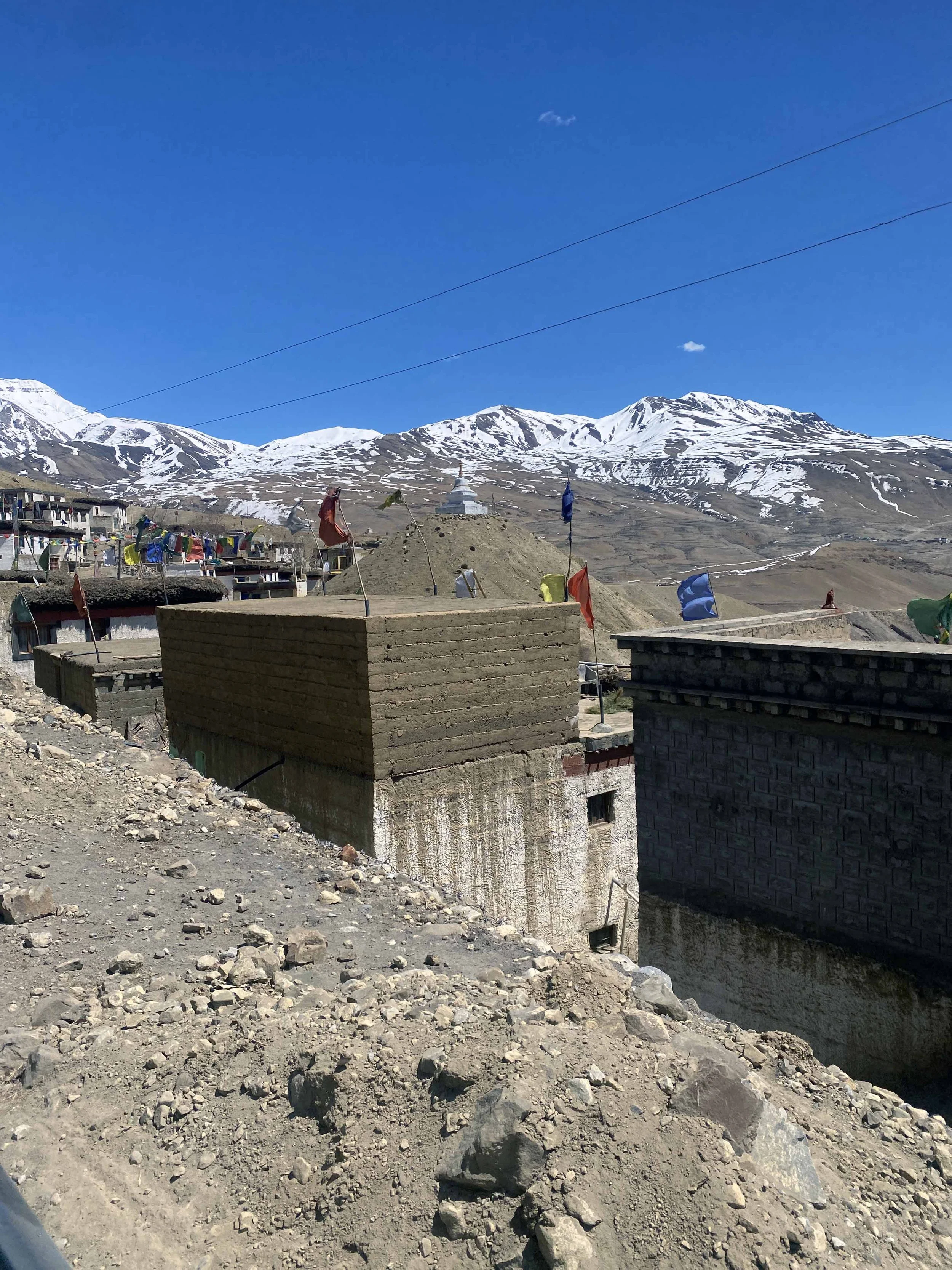
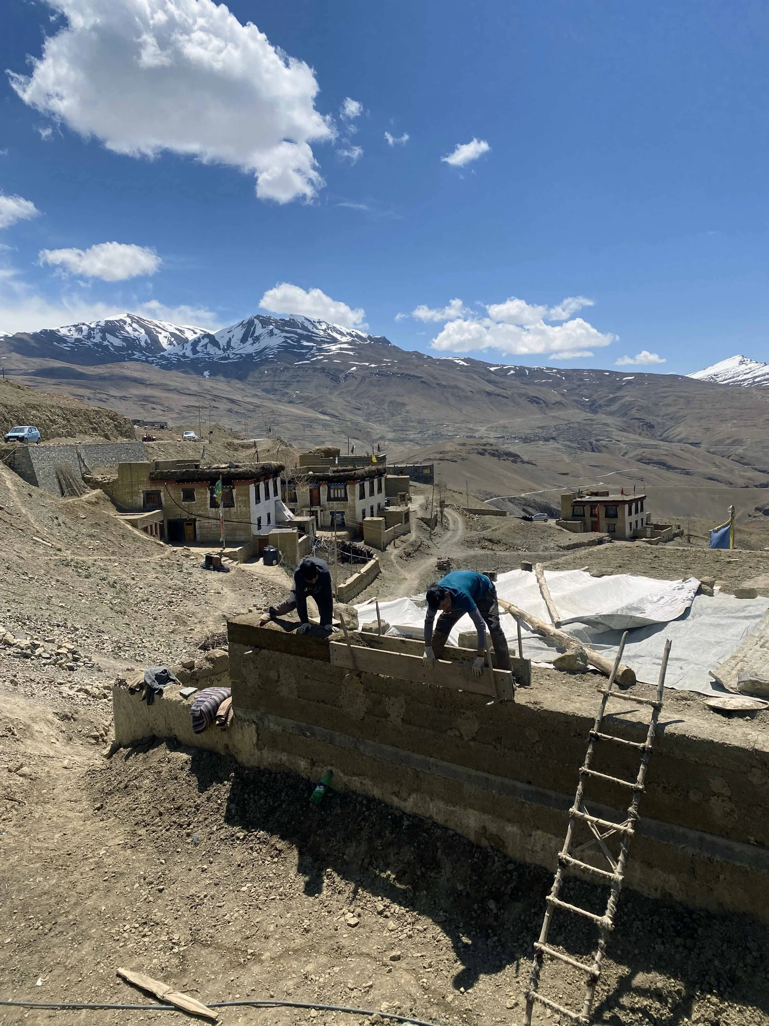
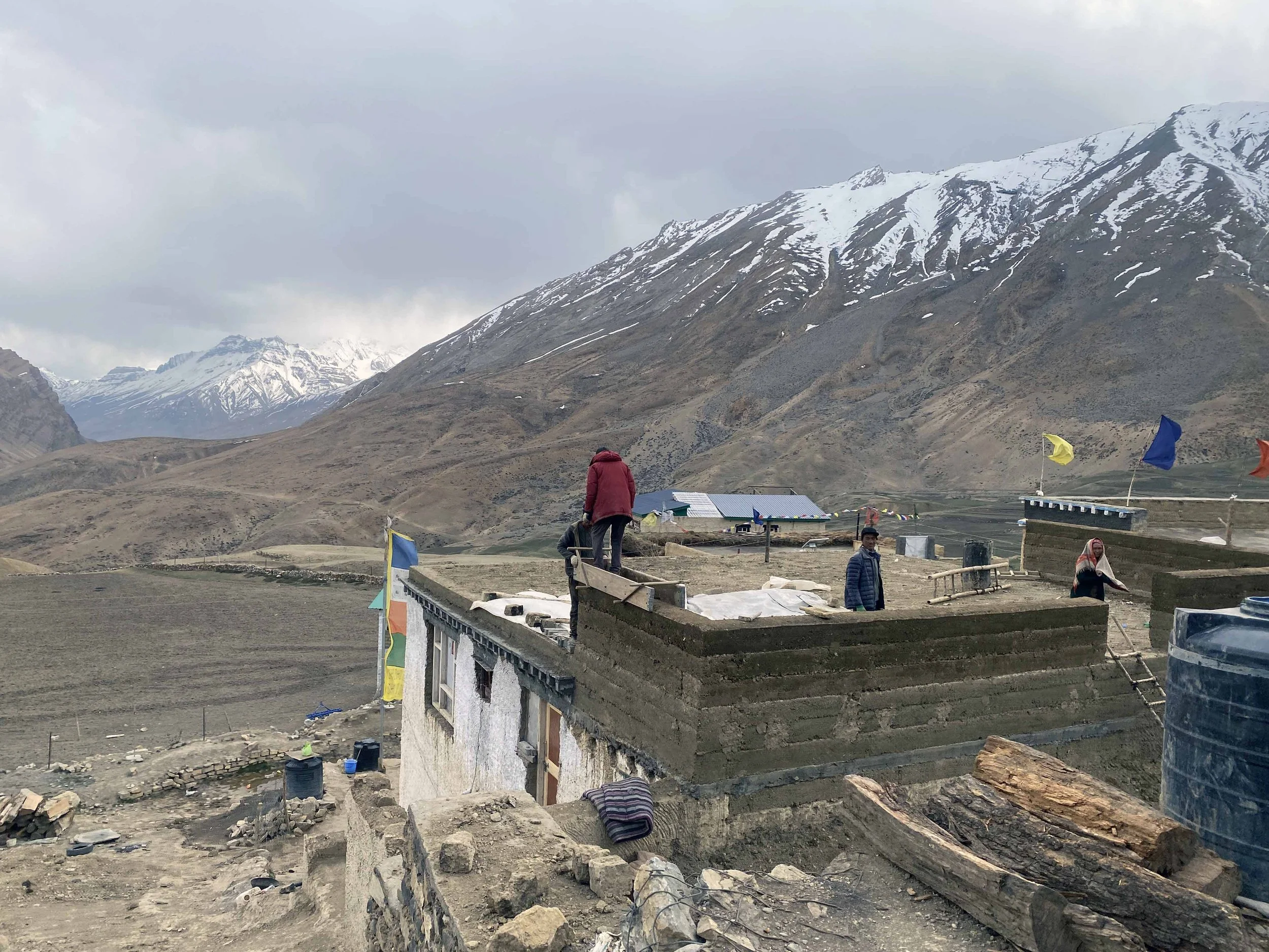
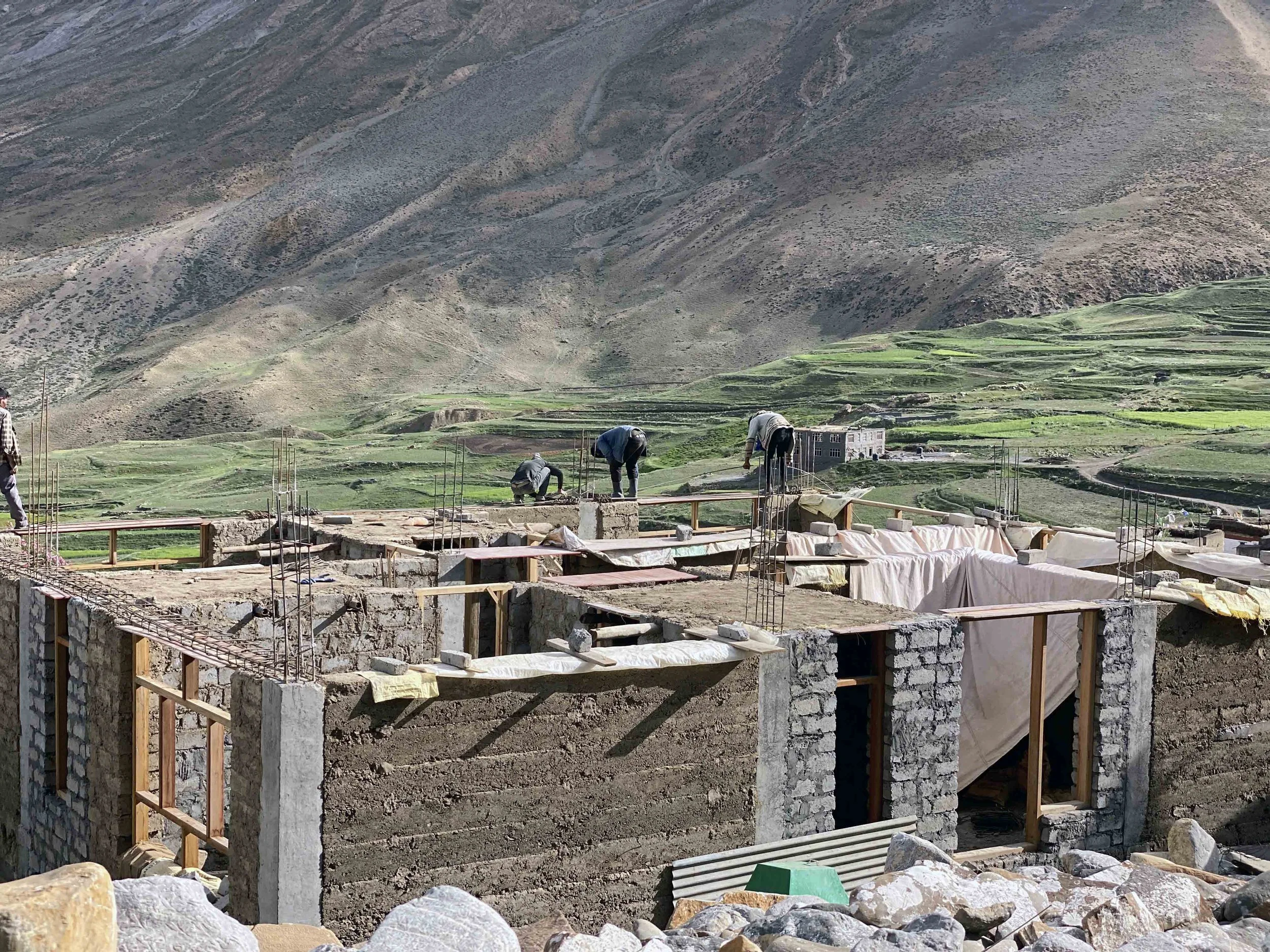
Spiti is a cold desert where timber is scarce, and mud is the primary construction material. Structures are built with rammed-earth walls, while timber is used exclusively for floors, roofs, and door and window frames. Natural stones are also scarce and are used only for foundations. Field analysis demonstrates that 1.5 - 2-foot-thick rammed-earth walls lower indoor temperatures by approximately 10°C in summer while preserving warmth in winter.
Stone Base - Up to Floor Height
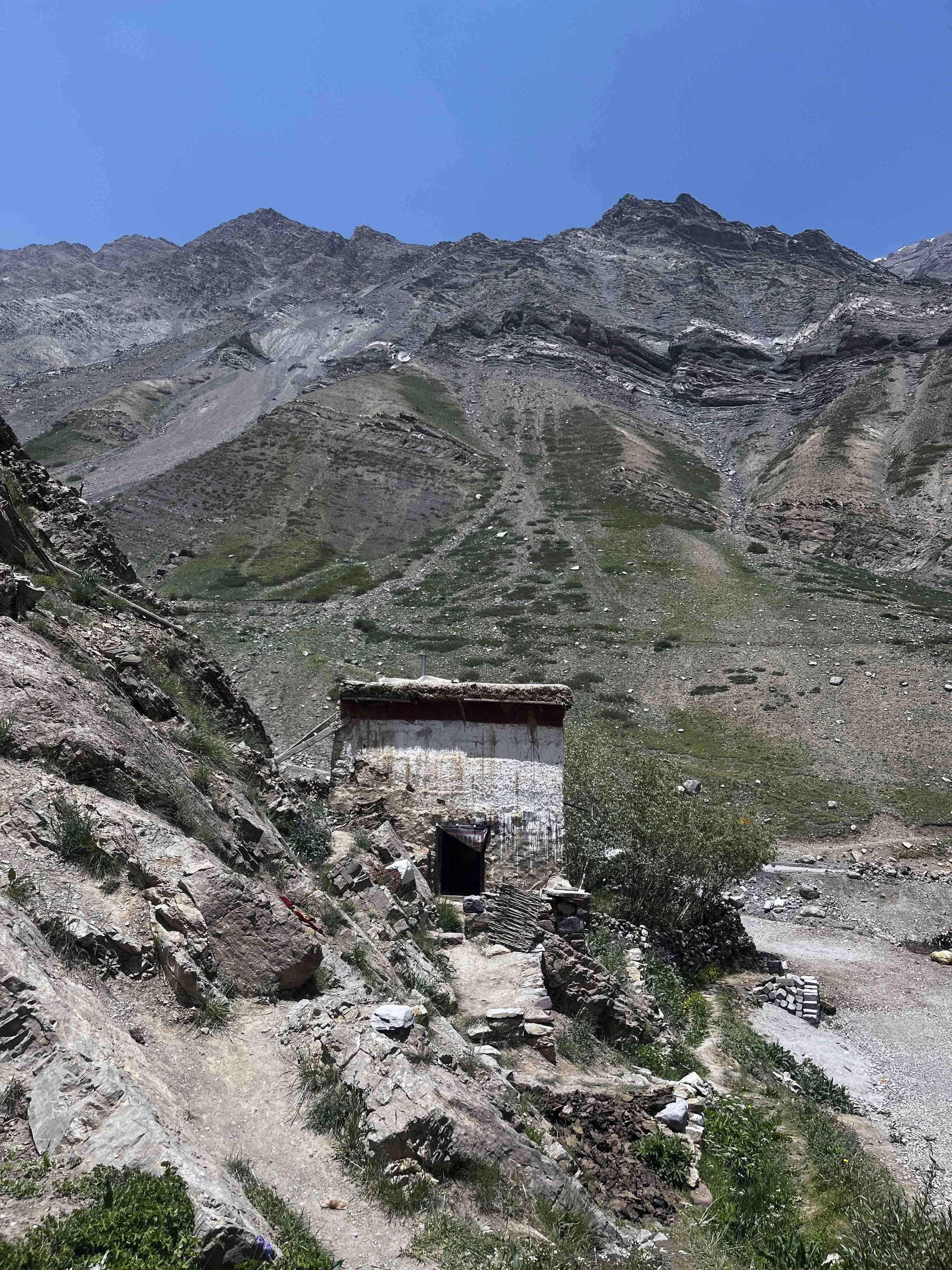
The substructure is generally built with hewn stone and mud mortar to support the upper floors. Sundried bricks tend to fail under immense pressure. Stone provides a stable base. Stone walls are constructed to floor height (approximately 2 feet thick) and keep snow at bay while also serving as retaining walls in contoured terrain. Buildings are set on rocky pedestals. Earth-berming along the north face aids thermal insulation against the cold north wind.
FOUNDATION
UPPER WALLS
Rammed Earth (Pisé) or Adobe (Pagbu)
The upper floors are constructed from sun-dried adobe bricks or rammed-earth walls. These walls serve a dual function by providing structural stability and seismic protection, as well as enhancing insulation and thermal regulation. Timber posts and frames are limited to essential structural elements due to restricted timber availability, which constrains room sizes. This scarcity also influences social patterns: smaller rooms foster intimate gatherings and close-knit domestic activities, shaping privacy norms. Families adapt by utilising shared spaces for both communal interaction and individual retreat.
Rammed earth | Pagbu (adobe) | 1.5–2 ft thick | -10°C summer effect
FLOOR + CEILING
Joists, Willow Twigs & Grass Insulation
The configuration of the wooden members varies depending on the room's span, and there may be more than one main beam. A series of joists is spaced evenly, perpendicular to the main beams. Willow twigs (tullu) are typically laid in rows over the joists, forming a pattern on the ceiling. The wooden substrates are covered with a thick layer of local grass for insulation. Willow, poplar, and juniper are used as structural members. Traditionally, windows were constructed with wooden lattice work and smaller openings, as glass was not available until the introduction of road connectivity.
Willow joists | Tullu (willow twigs) | Grass insulation layer | Juniper/poplar beams
DRY TOILET / CHASA
Chasa - Composting Sanitation System
Dry toilets (chasa) are stacked vertically with a common chute. The lower level of the house typically has no unusual openings, except when the distance from the adjacent ground level is small. Waste decomposes over time and becomes manure, which is accessed through an opening on the lower level and used to increase soil fertility in the fields. This system represents a complete zero-waste cycle integrated into the architectural program. The composting system's location within the house is carefully planned to ensure ventilation without compromising the warmth of the living spaces.
RITUAL CONSTRUCTION
Building as Ceremony
Construction and design practices in the region are inseparably linked to both ritualistic and physical aspects. The building process involves ceremonial rituals and blessings from lamas. Construction activities are undertaken by skilled craftsmen and masons, as well as by family members and neighbours who collaborate to support the building process. Labour is exchanged for materials or provided as part of a mutual understanding to assist one another. Construction knowledge is transmitted orally across generations, adapting to climate, culture, resource availability, and community needs.
05 MATERIAL PALETTE - SPITI VALLEY
A frugal palette, used with intelligence
The region's architecture emphasises the prudent use of scarce resources, relying extensively on mud and stone. The origins and refinement of these techniques are rooted in influences transmitted through religious and political channels from Tibet, Ladakh, Kashmir, Kullu, and Bushahr. The interrelationship between local material resources and applied techniques is understood as a direct response to resource availability, skills, usage, and human needs.
EARTH FORMS
Rammed Earth
Primary wall material - 1.5-2 ft thick - pisé de terre
Rammed earth is the primary construction material for upper walls. Walls with a thickness of 1.5 to 2 feet lower indoor temperatures by approximately 10°C in summer while preserving warmth during winter. The material consists of coarser earth with lower clay content than adobe. Most houses are earth-bermed on the north face. The wall's thermal mass stores heat during the day and releases it gradually throughout the night.
THERMAL MASS | 10°C COOLING EFFECT
Pagbu (Adobe)
Sun-dried brick - earth + water - upper floors
Sun-dried adobe bricks are used for upper-floor walls where the structural demand is lower than at the stone base level. The upper level is constructed with either adobe blocks or rammed-earth walls, both of which help maintain thermal comfort year-round. The higher clay content of pagbu compared to rammed earth makes it suitable for finer detailing and openings.
WALLS | ADOBE | CLAY-RICH
Mud Mortar + Plaster
Binding - waterproofing - surface finish
Mud mortar is used throughout the stone masonry base. Mud plaster is applied as a surface finish, providing a sacrificial weather layer. Traditionally, layers of local clays, mud and stone powders create waterproof roofs and dust-free plastered surfaces inside and out. Limestone is occasionally burnt in a kiln and mixed with water for whitewashes (kartsi), giving the characteristic white finish.
MORTAR | PLASTER | WHITE WASH
STONE
Hewn Stone
Foundation + ground floor - mud mortar - stone pedestal
Stone is used for foundations and ground floors, as the stone base supports the weight of rammed earth upper floors without failure (adobe and rammed earth tend to fail under immense pressure). Buildings are constructed on rocky pedestals, often utilising the existing rock as their foundation. Irregular, larger blocks are suitable for masonry, while rounded river stones are used for boundary walls.
FOUNDATION | GROUND WALLS | PEDESTAL
Dry Stone Masonry
Mortarless - temporary - doksa enclosures
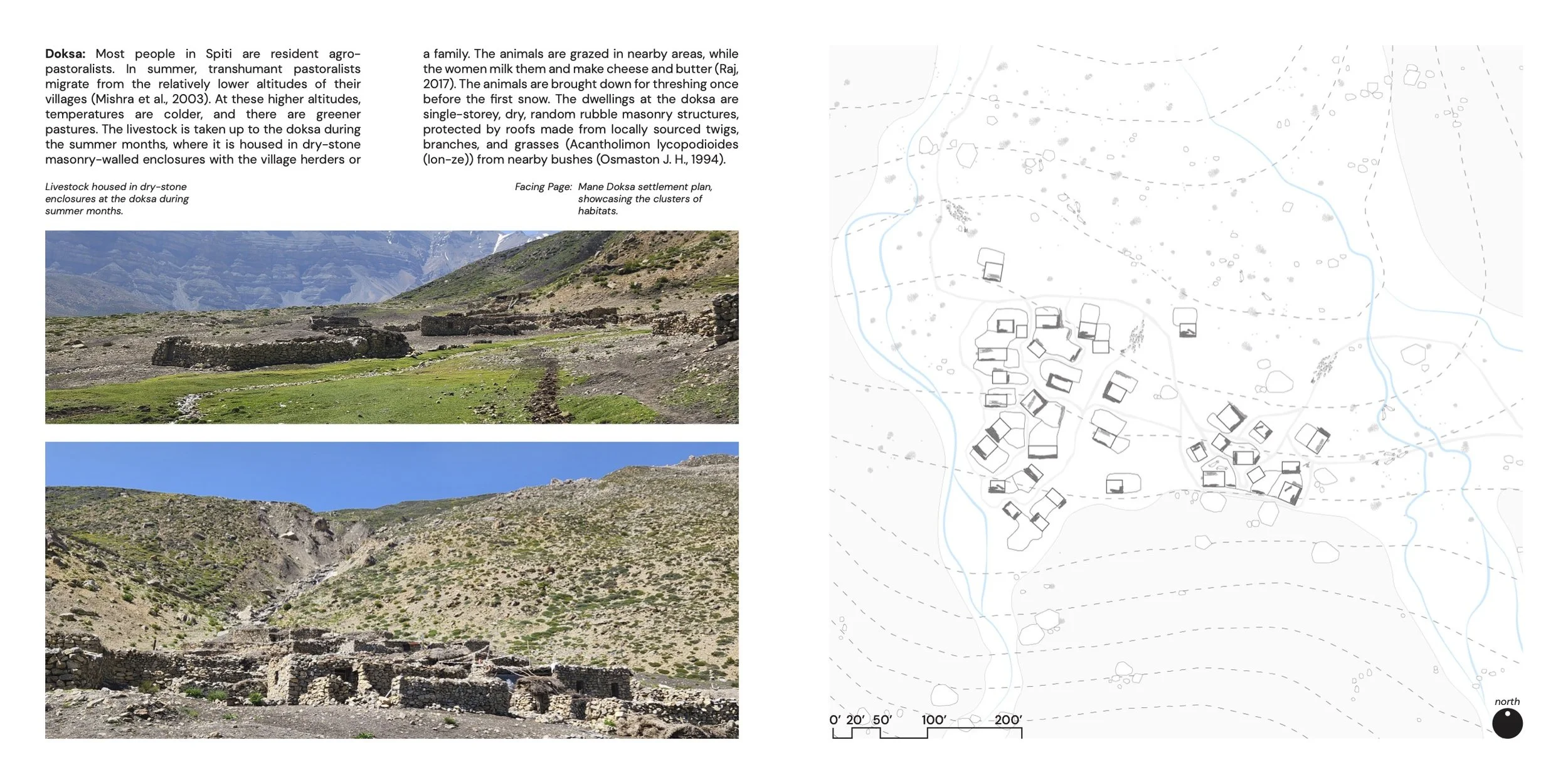
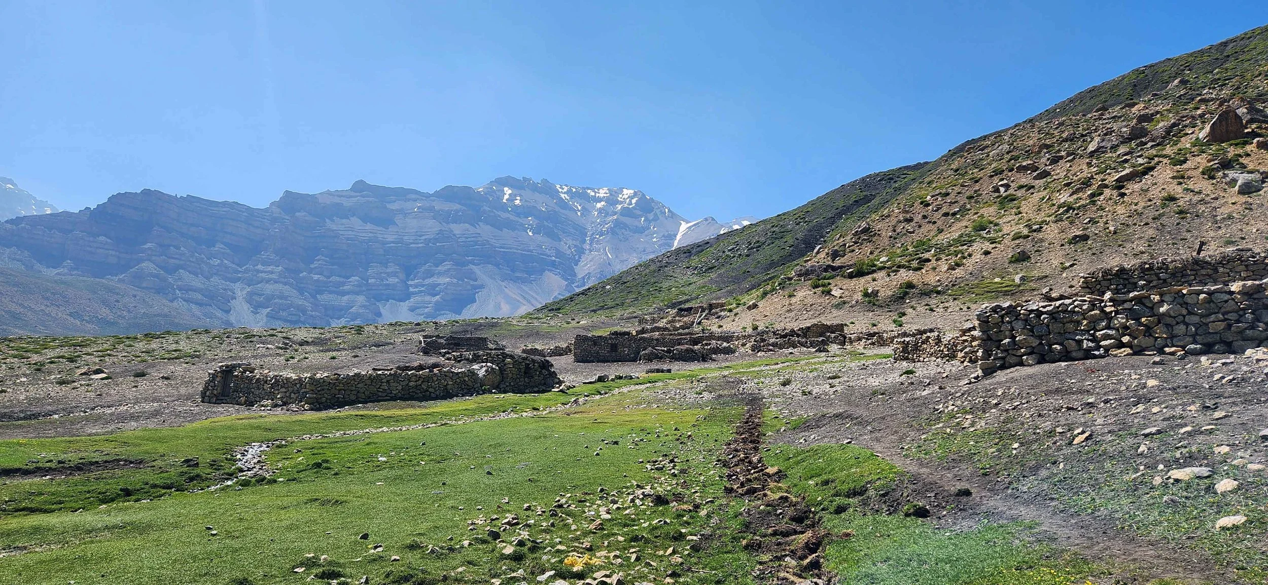
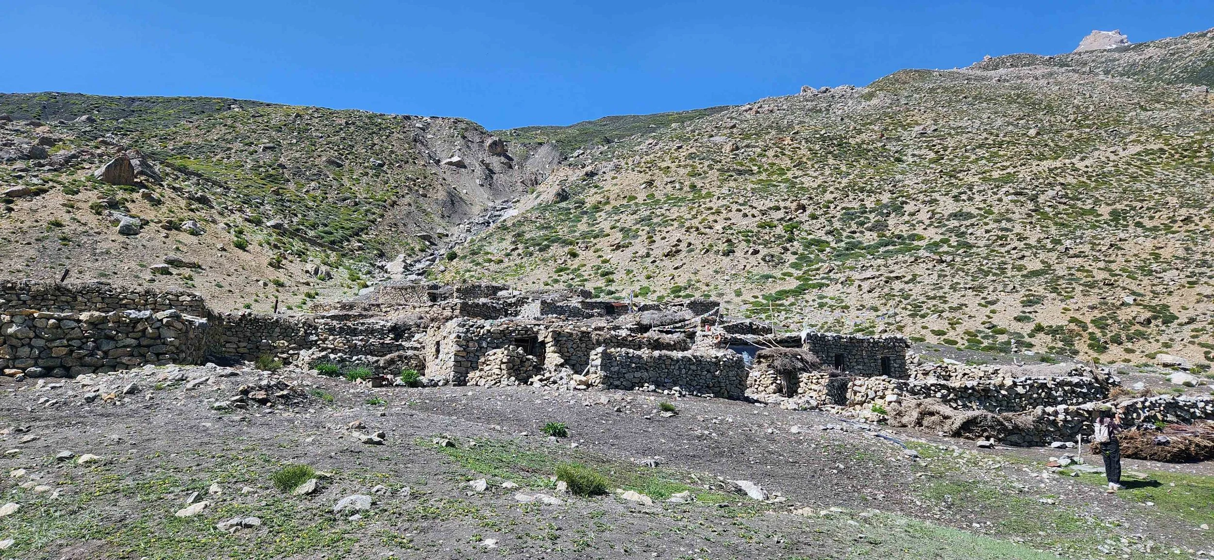
Mortarless dry stone masonry is used for doksa enclosures (pulu), zing ponds, chuda mills, and boundary walls. The dry joint construction provides seismic flexibility. Dwellings at the doksa are single-storey, dry, random-rubble masonry structures with roofs made of locally sourced twigs, branches, and grasses. Mani walls are also constructed using mortarless stone and are inscribed in Tibetan with hand-carved stone reliefs.
DOKSA | ZING | TEMPORARY | MANI WALL
TIMBER + INSULATION
Willow (Tullu) + Poplar + Juniper
Structural - floor boarding - door + window frames
Timber is scarce in Spiti and is used only for floors, roofs, and door or window frames. Willow twigs (tullu) are arranged in rows over joists, covering the ceiling in a woven pattern. Willow, poplar, and juniper serve as structural members. Limited timber availability directly constrains room sizes, and this scarcity shapes social patterns by fostering intimate gathering spaces. Traditional windows were constructed with wooden lattice work; glass was introduced with the advent of road connectivity.
JOISTS | BOARDING · FRAMES · SCARCE
Local Grass
Floor + roof insulation layer
A thick layer of local grass (lon-ze) is placed over the willow boarding before the mud layer, serving as thermal insulation for both floor and roof assemblies. The same grass is used to protect the roofs of the doksa enclosures. The wooden substrates are covered with grass insulation, after which the finishing earth is poured and compacted in several layers over the insulation.
INSULATION | FLOOR + ROOF ASSEMBLY
Twigs, Branches, Grasses
Doksa roofing - locally sourced from nearby bushes
Dwellings at the doksa are single-storey, dry random-rubble masonry structures protected by roofs made of locally sourced twigs, branches and grasses from nearby bushes. These minimal, impermanent roofing systems are maintained or replaced annually. The annual maintenance cycle of the doksa, including the installation of new roofs, reflects the community's deep knowledge of local material behaviour and availability.
DOKSA ROOFING | ANNUAL MAINTENANCE
06 COMMUNITY WATER SYSTEMS
Gravity-fed networks across 5 kilometres
Water supply is managed through a gravity-based distribution system that diverts snowmelt, glacial melt, or spring water via a layered network of community-owned and managed earthen channels. Traditional water sources such as khuls, magru, kua, khads, and nahllas continue to play a vital role in supporting daily life, conserving soil, and sustaining ecosystem services. Equitable water distribution and collective decision-making remain customary practices.
PRIMARY CHANNEL
Khul
Gravity irrigation channel - earthen - community-managed
Khuls, or water drains, are constructed to utilise gravity, tapping and diverting water from streams to farmlands and for domestic use. In Pangmo village, a khul system extends nearly 5 km, supplying water to almost 180 acres of farmland. Water channeled through the village is further diverted via water mills or collected in zings before being distributed into the fields.
STORAGE POND
Zing
Earthen pond - stone masonry embankment
An earthen storage pond with a stone-masonry embankment and mud mortar holds water, which is filled overnight and released once full. Villages such as Demul utilise community-based water storage, where glacier-melted water is stored in local tanks. Zings along the khul network in Pangmo regulate the flow and timing of irrigation across multiple parcels of farmland.
WATER-POWERED MILL
Chuda
Hargo - turbine (bibli) - grain bag (tongma)
Community or privately-owned water-run flour mills strung along the valley or in fields with diverted streams, used for milling grains post-harvest. The hargo (a directed water channel) opens above the bibli (a wooden turbine). The turbine rotation grinds grain between a moving and a stationary stone. The tongma (grain bag) hangs over the grinding stones, feeding grain continuously. Gue village documents a detailed chuda complex with a plan and section.
FARMLAND
Khad / Nahlla
Seasonal streams
Traditional water sources, including magru, kua, khads, and nahllas, continue to play an important role in supporting daily activities, conserving soil, and sustaining ecosystem services. During winter, water is carried from the river or a distant spring, or obtained by breaking the ice layer on the frozen river. Farmland is ideally located away from hamlets; some inhabitants possess two parcels, one near the house and another 5-7 km away.
07 DOKSA
Seasonal settlements
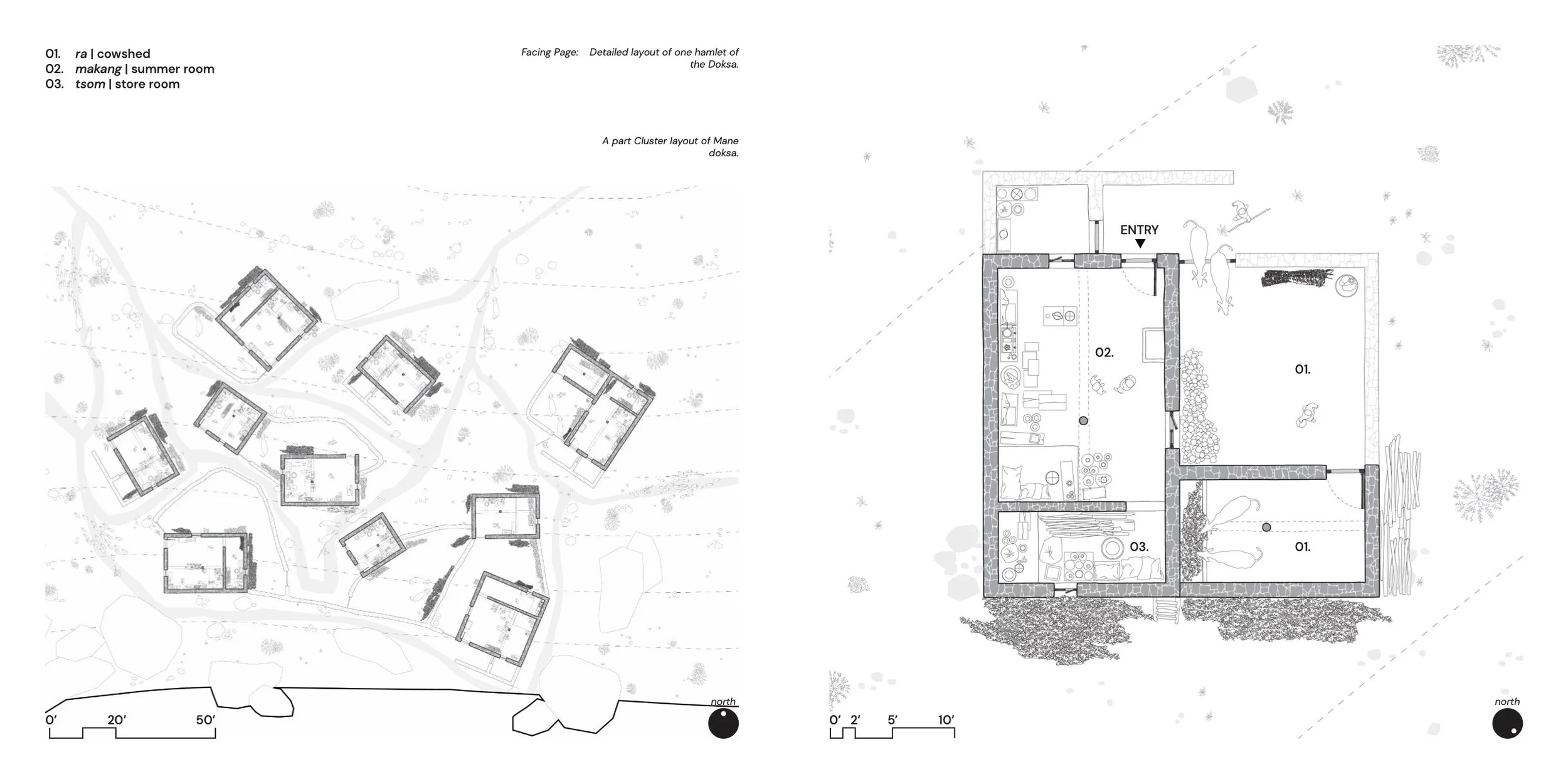
The majority of people in Spiti are resident agro-pastoralists. During the summer, transhumant pastoralists migrate from the relatively lower altitudes of their villages to higher pastures, where temperatures are colder and pastures are greener. Livestock is taken to the doksa during the summer months and housed in dry-stone masonry-walled enclosures with village herders or family members.
"Most people in Spiti are resident agro-pastoralists. In summer, transhumant pastoralists migrate to higher altitudes. The animals are brought down for threshing once before the first snow, the annual rhythm of the valley embedded in the architecture of both the permanent house and the seasonal doksa."
The encampment at the doksa is used by families for approximately four months each year. Multiple villages may share a common doksa. The settlement comprises hamlets, farmland, and the shared doksa. In some cases, farmland consists of two parcels: one in close proximity to the house and another located 5-7 km away. Major villages are those that have a monastery. A monastery may have multiple villages under its influence; in such villages, there is typically a small temple.
Ra - Cowshed
Dry-stone masonry enclosure for livestock
Shared between herders at the doksa site
Open pen with metre-high walls
Makang - Summer room
Minimal shelter used for sleeping and basic habitation through the four-month stay
No fixed furniture
Tsom - Store room
Used for storage and assisting the needs and spatial requirements for dairying, butter and cheese production in bulk to be traded